8/20/2023 - 8/26/2023
Climate in the News:
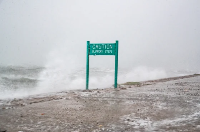
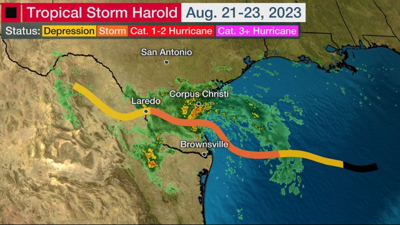
Last week was very reflective that the peak of the Atlantic Hurricane season is near, with many tropical systems in the Atlantic. The most notable was Tropical Depression Number Nine, which strengthened into a Tropical Storm Harold at 1 am on Tuesday August 22, before making landfall on Padre Island, TX just before 11 am. The storm maintained Tropical Storm force winds until the center reached Laredo, TX, where it was downgraded to a Tropical Depression around 10 pm. After that, it tracked north of the Sierra Madre Oriental Mountains until dissipating.
While only a Tropical Storm, Harold reached a peak sustained wind speed of 50 mph at its strongest; wind gusts were reported as high as 67 mph. The National Weather Service office in Corpus Christi reported a 24-hour precipitation accumulation of 4.90 inches on Tuesday. Overall, Harold brought some much-needed rain to South and West Texas, with minimal damage costs reported alongside it.
Weather Synopsis:
Recently, NOAA updated their forecast for the Atlantic hurricane season, outlined in the 8/6/2023 - 8/12/2023 weekly summary, to indicate above normal activity. This was due to anomalously warm sea surface temperatures. Therefore, one would have expected Harold to have been a damaging hurricane, as it had the warm waters of the Gulf of Mexico to fuel it. But, tropical systems need to meet many more parameters to maintain strength/strengthen than just an energy source. The case with Harold is, wind shear was present due to a nearby low pressure system in the upper atmosphere, which helped make the storm more disorganized. There was also a large-scale ridge, better known as an area of high pressure, over the south-central United States. This ridge was the major factor in determining the path Harold would take, as it followed the winds out of the southeast due to the anticyclonic or clockwise pattern of the wind around the high-pressure center.
Temperature:
Overall, summer days in August are hot across most of the region. It is hot both during the day and at night for most areas, with high humidity levels near the coast due to the prevailing southerly winds that bring moisture from the Gulf of Mexico.
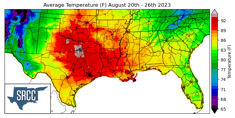
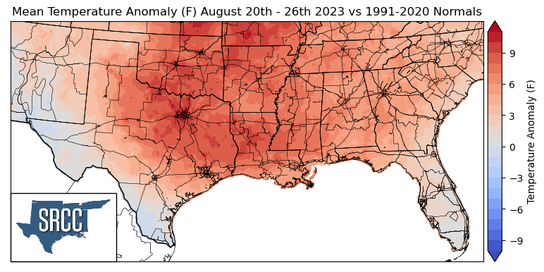
As August comes to a close, excessive heat warnings and advisories engulfed the majority of the central United States last week. A broad high-pressure center was situated over Missouri/Arkansas toward the middle of the week, shifting farther southeast toward the end of the week. This brought above-average temperatures to nearly the entirety of the southern climate region last week. Daily average temperatures reached as high as 95 degrees Fahrenheit in some areas of North Texas. Texas, Louisiana, and Oklahoma observed the warmest temperatures last week, with much of the tri-state area experiencing daily average temperatures ranging from 86 to 93 degrees. Nearly the entirety of the climatic region encountered above-average temperatures last week, with anomalies as high as 10 degrees higher than normal in North Central Texas, Central Oklahoma, and Central Louisiana, whereas temperature anomalies were only about 3 to 6 degrees above normal in Tennessee and the panhandle regions of Texas and Oklahoma.
While North Texas was experiencing the most dramatic above-average temperatures in the region, both South and far West Texas were able to experience some near-normal temperatures last week thanks to Tropical Storm Harold introducing a lot of added cloud cover to those areas, keeping daily high temperatures lower. This resulted in daily average temperatures as low as 70 degrees Fahrenheit in far West Texas.
Precipitation:
With the majority of the region being in a humid subtropical climate, rainfall is common at any point of the year. Frequently, during the summer months, sea breezes initiate thunderstorms and rain showers, which are quite common along the coastal areas.

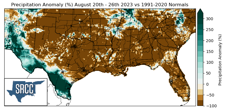
Overall, sizable amounts of precipitation were hard to come by this week in the southern climate region, with the exception of Tropical Storm Harold in South Texas. However, due to some showers last week in Western Tennessee, accumulated precipitation totals for that area averaged about 1.0 inch, where precipitation accumulation for the week was near normal.
Accumulated precipitation totals for the week along Tropical Storm Harold’s track averaged out to about 1.5 inches, with some areas near Corpus Christi, near the storm's landfall, receiving as much as 6.5 inches. Therefore, precipitation anomalies in South and West Texas last week were 300% greater than normal.
But while Harold was able to bring some much-needed rain to a small portion of the climate region, the rest of the climate region experienced precipitation anomalies around -100%, only fueling worsened drought conditions for areas in North Central Texas, Oklahoma, Louisiana, Arkansas, and Mississippi.
Records/Extremes:
- 8/20/2023: College Station, TX: Tie for hottest temperature ever recorded at 112°F
- 8/22/2023: Duval County, TX: 4.23 inches of rain via CoCoRaHS submission associated with Tropical Storm Harold after making landfall
- 8/24/2023: Houston, TX: Tie for hottest day of record with high of 109°F
- 8/24/2023: Nashville, TN: First time Nashville hit 100°F since September 2022
- 8/26/2023: Waurika, OK: Winds up to 63 mph