2/11/2024 - 2/17/2024
Climate in the News:
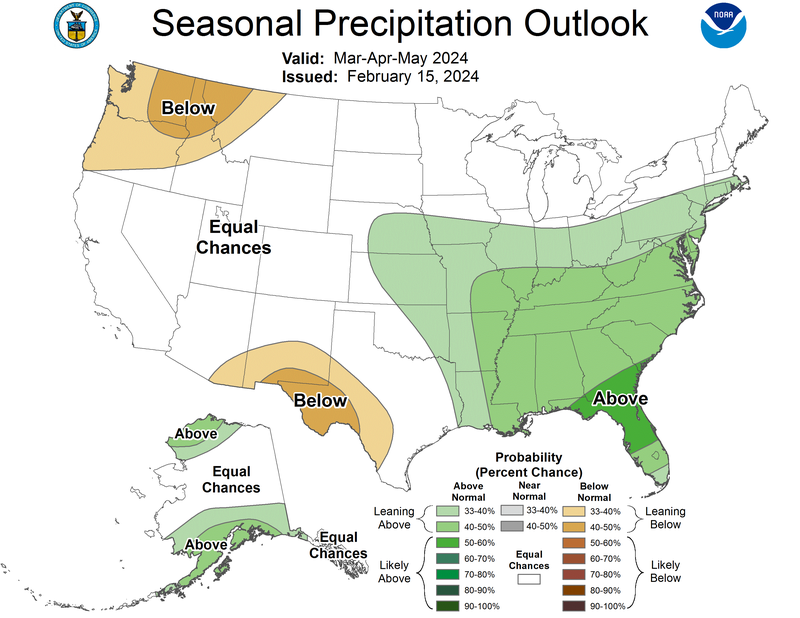
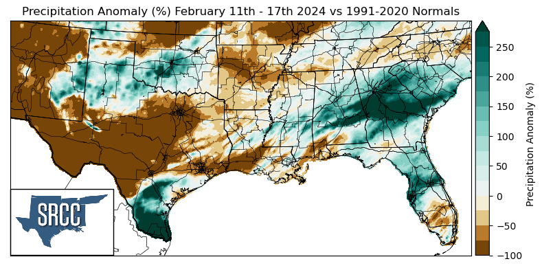
Last week the Climate Prediction Center issued a new Seasonal Precipitation Outlook, for this meteorological spring. For the southern region, below-normal precipitation chances are forecast in Far West Texas which could contribute to persistent and worsening drought conditions in the area. However, in Tennessee, Mississippi, Louisiana, Arkansas, eastern Oklahoma, and deep east Texas, above-normal precipitation chances are expected as El Niño conditions turn to ENSO-neutral conditions.
Weather Synopsis:
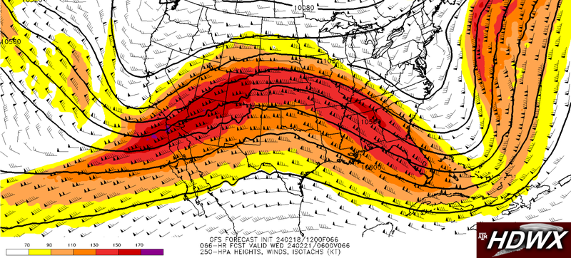
Next week above-average temperatures are forecasted for much of the lower 48, this is because a large upper-level ridge is anticipated over the Great Plains. This ridge, indicated by the upside-down “U” shape on the map below will result in high pressure and warm temperatures next week.
Temperature:
Overall, February is when the Region is consistently seeing cooler temperatures. Frequent cold fronts bring with them colder air masses from the northern United States and Canada, bringing freezing temperatures to the northern portions of the Region.
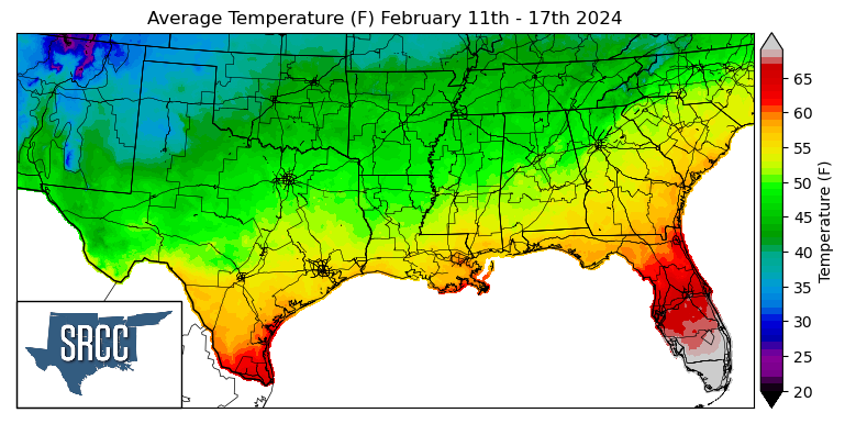
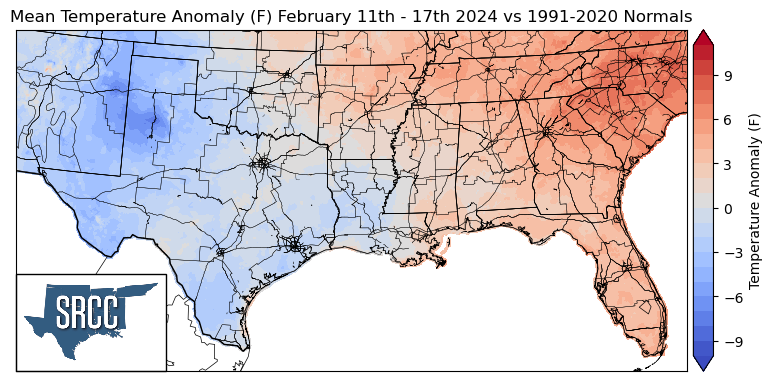
Temperatures remained near or slightly above normal for the region last week until over the weekend a cold front made its way through the Region, leaving behind temperatures well below normal in Texas. This resulted in weekly average temperatures below normal to near normal in Oklahoma, Texas, and Louisiana. While weekly average temperatures in Arkansas, Mississippi, and Tennessee were slightly above normal. Overall temperatures for the week ranged between 55 and 40 degrees Fahrenheit, about 7 degrees colder than the week prior.
Precipitation:
With the majority of the Region being in a humid subtropical climate, rainfall is common at any point of the year. Frequently, during the winter months, cold fronts bring with them showers, thunderstorms, and even frozen precipitation to the Texas panhandle, Oklahoma, Arkansas, and Tennessee. The boundary between the cold and warm air masses serves as a trigger mechanism for storms.
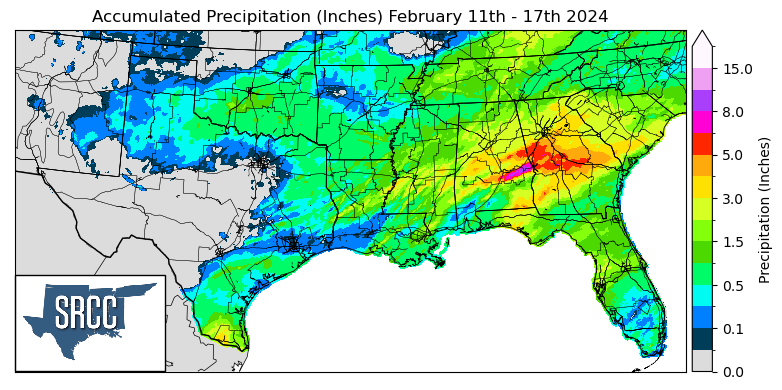
In terms of precipitation across the Region last week there was no one driving factor for the observed rainfall. Showers and thunderstorms in east Texas to Mississippi on the 11th were thanks to a stationary front, discussed in last week's summary. Particularly high weekly accumulations in the Lower Rio Grande Valley can be attributed to sea-breeze initiated showers and thunderstorms. However, the highest daily accumulation was in Nacogdoches, County in East Texas of 4.89 inches via a CoCoRaHS report Sunday.