2/04/2024 - 2/10/2024
Climate in the News:
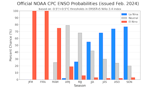
This winter El Niño has made a large impact on the weather in the Southern United States, but as winter turns into spring we see higher probabilities for a shift from El Niño conditions to more ENSO-neutral conditions. By the summer higher probabilities for La Niña conditions are projected. In the February ENSO Outlook NOAA officially issued a La Niña watch. To read more about the switch from El Niño to La Niña read the latest ENSO Blog, here.
Weather Synopsis:
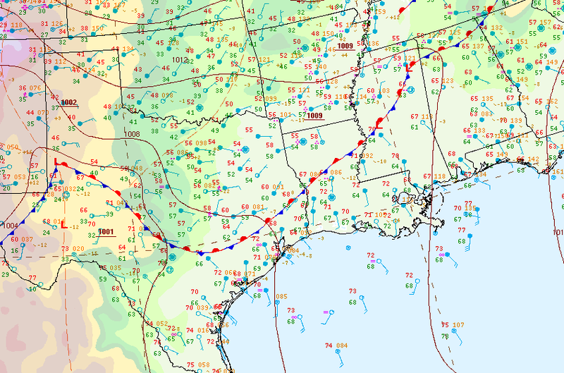
A stationary front was draped across the southern region this past Saturday, this was the leading cause for most of the precipitation seen last week. As this boundary sat, several severe thunderstorms fired up along the boundary. High winds and one-inch hail were seen in areas of Central Texas Saturday morning.
Temperature:
Overall, February is when the Region is consistently seeing cooler temperatures. Frequent cold fronts bring with them colder air masses from the northern United States and Canada, bringing freezing temperatures to the northern portions of the Region.
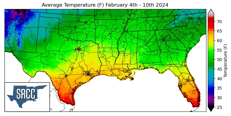
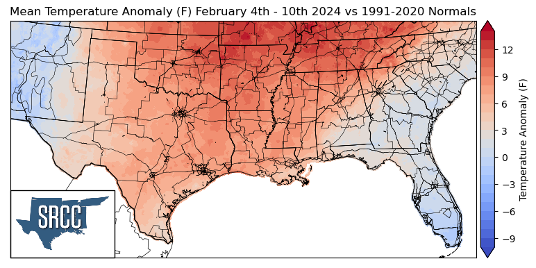
More spring-like temperatures were observed across the Southern Region last week, as upper-level ridging was experienced the majority of the week leading to surface high pressure. This led to above-normal weekly average temperatures across the region, with northern Arkansas and Tennessee seeing temperatures as much as 12 degrees Fahrenheit above normal. Overall temperatures for the week ranged between 62 and 47 degrees Fahrenheit, about 5 degrees warmer than the week prior.
Precipitation:
With the majority of the Region being in a humid subtropical climate, rainfall is common at any point of the year. Frequently, during the winter months, cold fronts bring with them showers, thunderstorms, and even frozen precipitation to the Texas panhandle, Oklahoma, Arkansas, and Tennessee. The boundary between the cold and warm air masses serves as a trigger mechanism for storms.
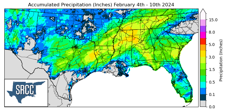
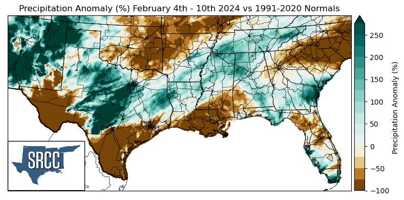
As mentioned briefly above, most of the precipitation seen last week was due to a stationary front that draped itself across the region on Saturday. Central Texas managed to receive the most significant amount of rainfall from this event, but areas of northern Louisiana, southern Arkansas, northern Mississippi, and Tennessee also saw moderate amounts of precipitation. The highest daily precipitation total seen out of this system was in Uvalde County, TX, where 2.37 inches of rain was reported via CoCoRaHS on Saturday.