10/29/2023 - 11/04/2023
Climate in the News:
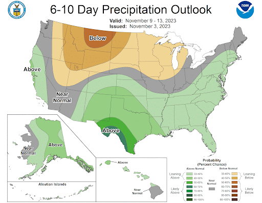
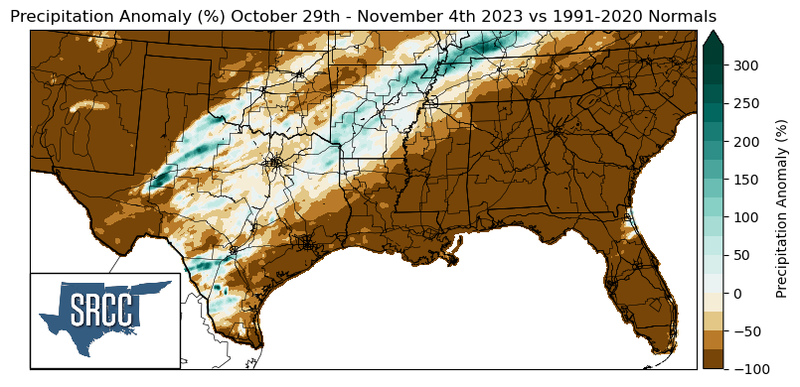
It is known that during El Nino, the Southern United States can expect wetter conditions during the cool season. By the end of this week, the Rio Grande Valley is forecasted to get a taste of this, as the Climate Prediction Center’s, 6-10 Day Precipitation Outlook has the Valley at 53% - 70% of above normal precipitation. Forecasted rain totals by the Weather Prediction Centers through the week are up to 5 inches in Brownsville, TX, with the majority of the Rio Grande Valley seeing at least an inch.
Weather Synopsis:
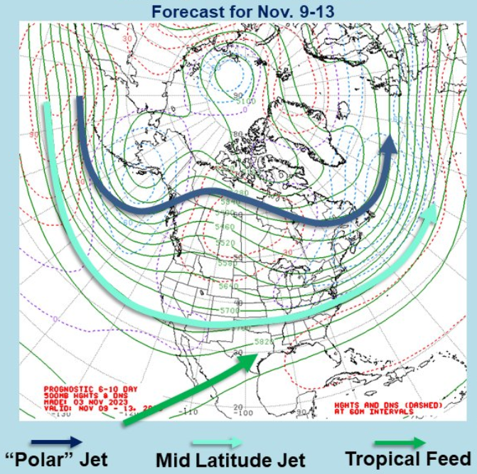
For weather to happen at the surface it needs to have support from the levels of the atmosphere above it. A particularly defining characteristic of a typical El Nino is the presence of the Mid Latitude Jet (or Subtropical Jet). To read more about how the jet is affected during El Nino events refer to the 10/8/23 - 10/14/23 Weekly Summary. The subtropical jet brings weather disturbances to Texas, and when there’s enough moisture around, the state receives precipitation. This sort of situation may be in the cards toward the end of this week, with the subtropical jet nearby and moisture being brought northward from the tropics.
Temperature:
Overall, November is when most of the region starts to see temperatures cooling down. Weekly cold fronts are quite common, bringing with them colder air masses from the north.
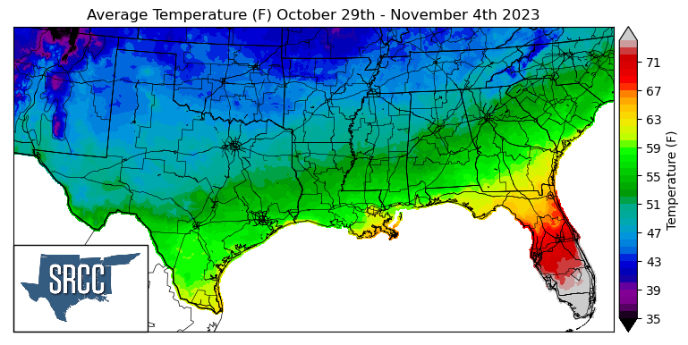
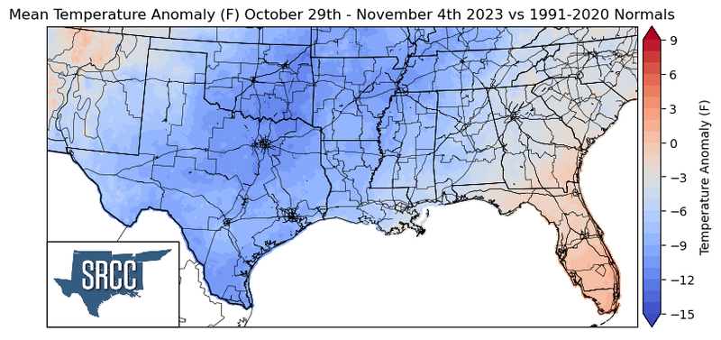
On the last weekend of October, a cold front swept through the southern region bringing with it a colder air mass from the north. This caused temperatures to plummet and brought winds from the north, advecting that cold air into the region. Due to this strong cold front, temperatures were well below normal all across the central plains into the southern region. Daily average temperatures for the week were as much as 13 degrees Fahrenheit below normal in North-Central Texas and Southern Oklahoma, giving the region an early taste of winter this fall. Along the northern states of the region, the daily average temperature sat around 44 degrees. The temperature for the majority of the region ranged between 58 to 43 degrees Fahrenheit, with the upper bound of this range being more than 20 degrees lower than the previous week.
Precipitation:
With the majority of the region being in a humid subtropical climate, rainfall is common at any point of the year. Frequently, during the fall months, cold fronts bring with them showers and thunderstorms. The boundary between the cold and warm air masses serves as a trigger mechanism for storms.
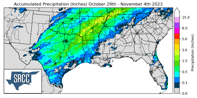
The majority of the rainfall seen last week was largely due to the cold front as it passed through the region leading to widespread showers. But these accumulations were quite moderate, with Northeast Arkansas receiving the highest accumulations - near 4 inches. Otherwise, the region remained dry last week with Far West Texas, the Panhandle region, the South Texas coast, southern Louisiana, Southern Mississippi, and Eastern Mississippi receiving no measurable precipitation.
Records/Extremes:
- 10/29/2023: Lampasas & Brewster County, TX: 2 stations had record low daily temperature averages
- 10/30/2023: Texas: 42 stations had record low temperature daily averages
- 11/2/2023: Natchitoches, LA: Daily Record Low Temperature at 30°F