10/08/2023 - 10/14/2023
Climate in the News:
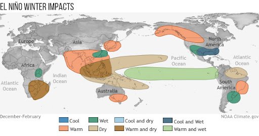
As this year continues climatologists are observing the current El Niño event getting stronger. Currently, there is an 80% chance that El Niño will continue through spring. ENSO forecasters also expect there to be a 75-85% chance it will become a strong event this spring. This El Niño event will affect the southern climate regions by leading to a cool and wet winter, as displayed on the map below. This is because during El Niño the strongest portions of the jet stream tend to shift southward, guiding storms across the Southern U.S. To read more about the current state of the El Niño Advisory, read the latest ENSO Blog by NOAA.
Weather Synopsis:
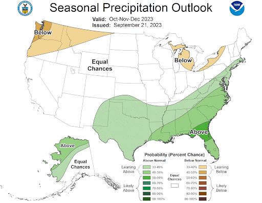
Outlined below in the Climate Prediction Center’s Seasonal Precipitation Outlook, almost all of the southern climate region is inside some probability for above-normal precipitation chances, and this lines up with what we would expect out of an El Niño winter. The reason why the Southern U.S. sees more precipitation during an El Niño winter as discussed above, is the jet stream. During El Niño the strongest portions of the jet stream move south over the Southern U.S., where disturbances on the jet stream can trigger low pressure systems and intense vertical motion.
Temperature:
Overall, fall days in October are fairly comfortable across most of the region. Although, weekly cold fronts are quite common bringing with them colder air masses from the north.
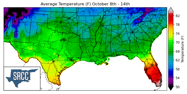
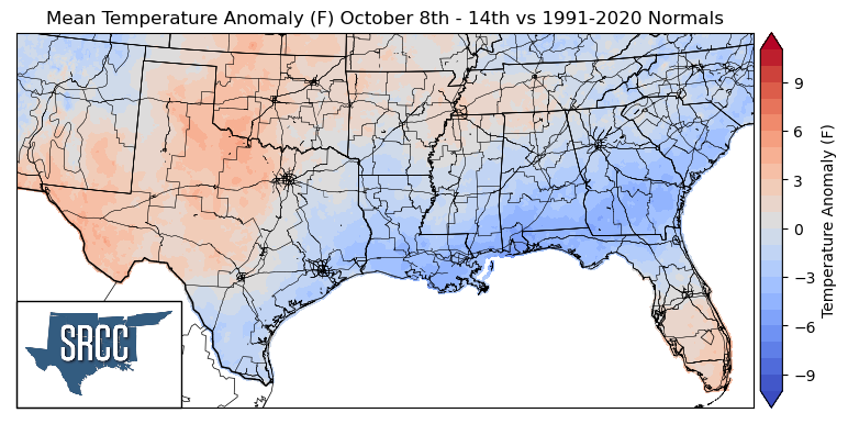
As October continues, Fall-like and seasonal temperatures came back last week to the southern climate region led by a cold front late in the week. This brought the region from seeing above-normal temperatures mid-week to below average temperatures to the majority of the region by the end of the week. But looking at mean temperatures for the week, temperatures were slightly above normal in West Texas, North-Central Texas, and Oklahoma. In contrast, in East Texas, South Texas, Arkansas, Louisiana, Mississippi, and Tennessee below and near-normal temperatures were experienced, leading to daily average temperatures ranging from 70 to 62 degrees Fahrenheit for the rest of the majority of the southern region.
Precipitation:
With the majority of the region being in a humid subtropical climate, rainfall is common at any point of the year. Frequently, during the fall months, cold fronts bring with them showers and thunderstorms. The boundary between the cold and warm air masses serves as a trigger mechanism for storms.
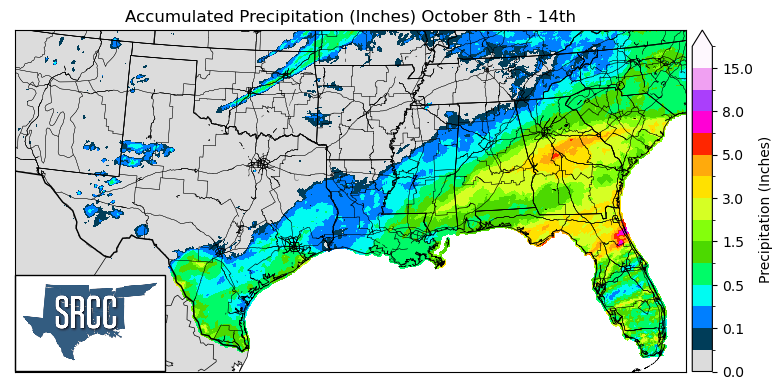
Unfortunately, last week's cold front, while it did bring cooler temperatures, did not bring much in terms of precipitation, leaving much of the southern climate region dry last week. Widespread precipitation was only seen along the coast due to a warm front in the Gulf of Mexico mid-week that moved onshore.
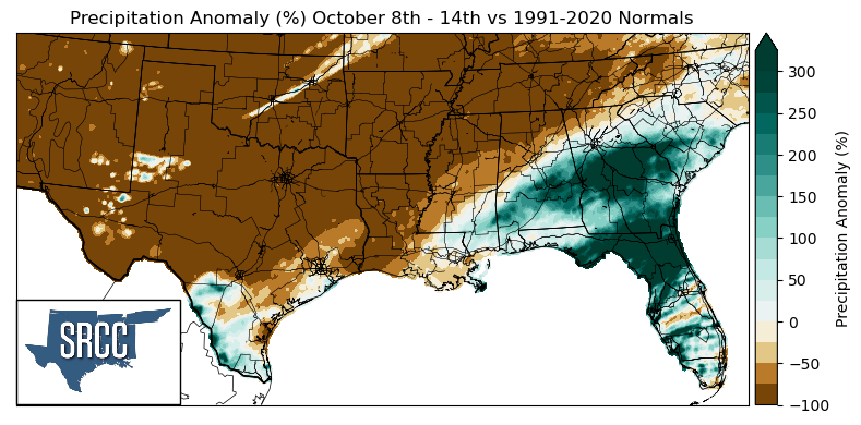
Due to a widespread lack of precipitation, the majority of the southern climate region saw precipitation anomalies of -100%, including North, West, and Central Texas, Oklahoma, Louisiana, Arkansas, Tennessee, and Northern Mississippi.
Above-normal precipitation was not experienced at large anywhere in the climate region last week. But, South Texas and Southern Mississippi at least experienced near-normal precipitation amounts for the week.
Records/Extremes:
- 10/14/2023: Annular Solar Eclipse, with Midland, San Antonio, and Corpus Christi, TX, in the path of annularity