9/03/2023 - 9/09/2023
Climate in the News:
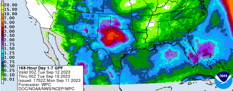
Thanks to a shift in the upper-level weather pattern the seemingly never-ending heat dome is going away, allowing for more fall-like temperatures. This shift will also allow for more showers and thunderstorms, leading to much of the climate region expecting to see above-average precipitation next week. Outlined in the 7-Day Total Precipitation forecast, by the Weather Prediction Center areas in North-Central Texas can expect to see between 2.5 to 4.5 inches of rain. This rain combined with more seasonable temperatures will play a large role in helping not only keep drought from expanding but help some areas see improvements. As of September 5th, 76% of the Southern Climate Region is experiencing some level of varying drought conditions. To see how forecasted above-average precipitation for much of the region this week will affect drought conditions, check back every Thursday to read our Weekly Drought Update.
Weather Synopsis:
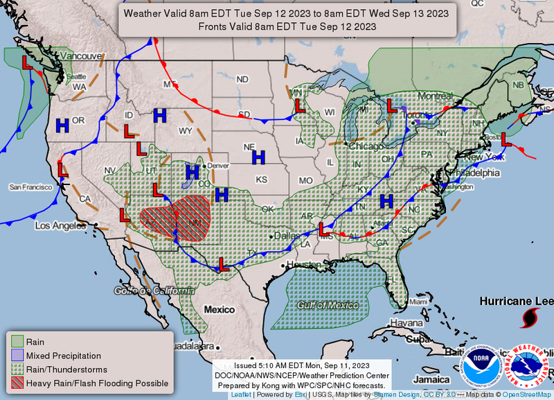
Shows by the surface analysis map below, a cold front is forecasted to be pushing through the southern region on Tuesday, September 11th. This cold front will bring with it the chance of showers and thunderstorms for much of the region as warmer, less dense air rides over the cooler more dense air, creating a lifting mechanism for storms.
Temperature:
Overall, fall days in September are still fairly warm across most of the region. Although, weekly cold fronts are quite common bringing with them cooler, more fall-like temperatures.
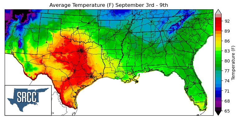
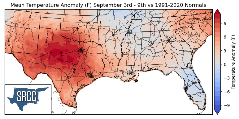
As we enter September, excessive heat warnings and advisories still linger around the southern climate region. A broad high-pressure center was situated over Texas toward the beginning of the week. This brought above-average temperatures to Texas, Oklahoma, and Louisiana. Daily average temperatures reached as high as 93 degrees Fahrenheit in North-Central, Central, and South Texas, leading to temperatures as much as 12 degrees Fahrenheit above normal in North-Central Texas. In contrast, in Arkansas, Mississippi, and Tennessee near-normal temperatures were experienced, leading to daily average temperatures ranging from 83 to 70 degrees Fahrenheit in the three states.
Precipitation:
With the majority of the region being in a humid subtropical climate, rainfall is common at any point of the year. Frequently, during the fall months, cold fronts bring with them showers and thunderstorms. The boundary between the cold and warm air masses serves as a trigger mechanism for storms.
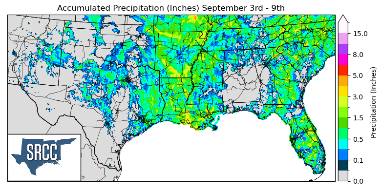
Last week's frontal passage through Arkansas, Louisiana, Mississippi, and Tennessee brought showers and thunderstorms to the three states. Thanks to this frontal boundary and the storms it produced, widespread precipitation was observed in these states. The drought-stricken state of Louisiana was even able to see an accumulated precipitation average of 1.5 inches for the week.
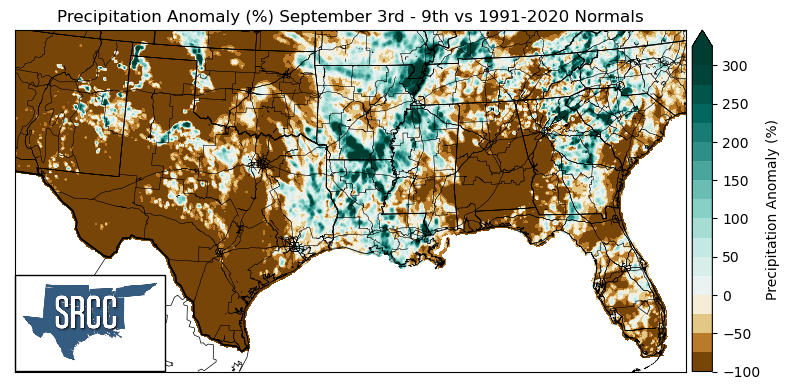
Unfortunately, not all of the climate region was lucky enough to receive widespread precipitation. The majority of Texas and Oklahoma saw little to no precipitation last week, leading to precipitation anomalies of -100%.
The areas that witnessed above-average precipitation compared to normal were primarily in Louisiana, Arkansas, and Northern Mississippi. Some of the largest precipitation anomalies experienced were in Northwest Arkansas and Southern Arkansas where precipitation was about three times normal.
Records/Extremes:
- 9/3/2023: Abilene, TX: Record Daily high temperature set at 105°F
- 9/6/2023: Corinth, MS: Golf ball size hail (1.75 inches)
- 9/6/2023: El Paso, TX: Record Daily high temperature set at 104°F and ties all-time hottest temperature in the month of September
- 9/7/2023: Shreveport, LA: Record Daily high temperature set at 108°F, making it the 2nd hottest September day on record
- 9/7/2023: Philadelphia, MS: 76 mph wind gust