3/31/2024 - 4/6/2024
Climate in the News:
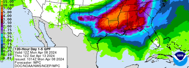
The Southern Region is entering an active weather pattern this week. There is the risk for severe weather centered today in Texas and Wednesday in Louisiana and Mississippi. In light of this multi-day severe weather threat, it's recommended to have multiple ways to receive watches and warnings and take the appropriate precautions when necessary. The Southern Region can also expect to see flash flooding associated with this severe weather event. Displayed below is the Weather Prediction Center's 5-Day Quantitative Precipitation Forecast and it has much of the Lower Mississippi Valley and the ArkLaTex region receiving at least 4 inches of rain, with up to 10 inches along the Arkansas-Louisiana border.
Weather Synopsis:
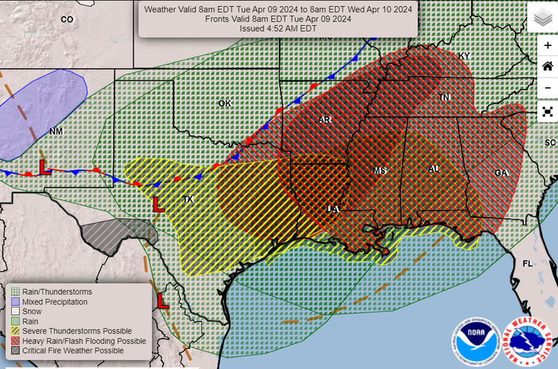
Severe weather is expected to be ongoing from the early hours Tuesday through Wednesday. All severe threats are possible with these storms from Texas to the Lower Mississippi Valley. According to the Storm Prediction Center, “several tornadoes, a couple of which should be strong, significant large hail, and damaging winds are likely.” The driver for this weather system is the low-pressure system in Central Texas and its associated surface boundaries.
Temperature:
Overall, April is when the Region is starting to see consistently warmer temperatures. However, regular cold fronts are still common bringing both rain chances and below-normal temperatures for a few days.
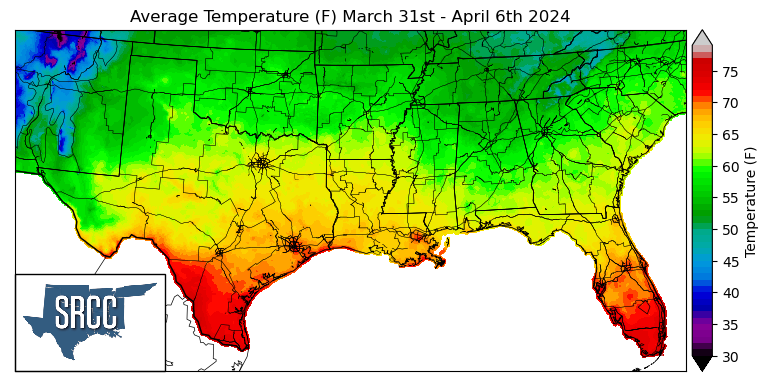
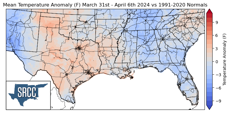
Temperatures were relatively mild across the Southern Region this week. Temperatures were slightly above normal in Texas and Western Oklahoma, while Louisiana saw near-normal temperatures, and the rest of the region experienced temperatures slightly below normal. Due to these mild temperatures, no significant departures from the weekly normal were observed. Overall average temperatures for the week ranged between 68 and 52 degrees Fahrenheit, fairly similar to the week prior.
Precipitation:
With the majority of the Region being in a humid subtropical climate, rainfall is common at any point of the year. During the spring months, storm systems are common throughout the south. During April severe storm probabilities are at their highest in Oklahoma and Northeast Texas.
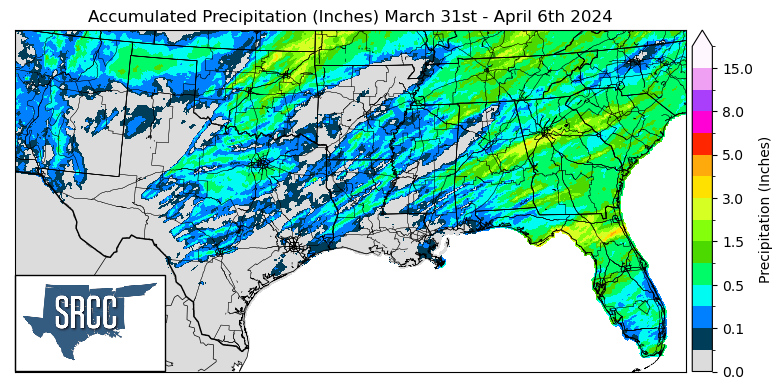

Precipitation last week across the Southern Region was overall quite sparse. Most of the precipitation received last week was on Monday into Tuesday morning as a cold front advanced southwestward through the Region. The highest daily accumulation was seen in Ottawa County where 2.04 inches of rain fell in Northwest Oklahoma according to a CoCoRaHS report Tuesday. This contributed to a weekly accumulation of 3 inches in the county.