3/10/2024 - 3/16/2024
Climate in the News:
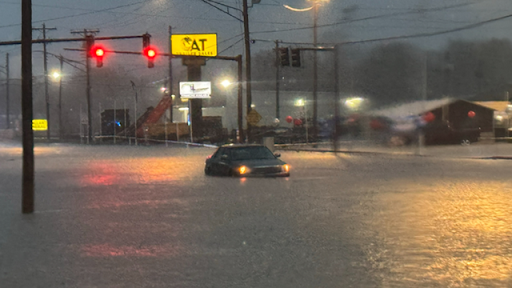
As storms moved through the Region last week severe thunderstorms led to flash flooding in Oklahoma and Arkansas Thursday into Friday morning. This resulted in several state highways closing due to flooding. In 24 hrs up to 6 inches of rain fell in central and southwestern Arkansas. High water rescues occurred in Maumelle, Arkansas when residences were rescued from townhomes by first responders. If you find yourself in a flash-flooding situation remember 12 inches of fast-moving water can carry away a small car. Turn Around Don’t Drown!
Weather Synopsis:
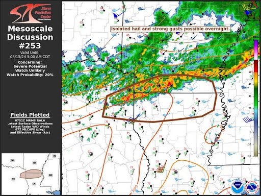
As a cold front advanced southward into Louisiana, so did severe thunderstorms organized into a line of storms. This line of thunderstorms led to an EF-2 tornado in Hot Springs Village, Arkansas, thankfully, no injuries or deaths were reported. The squall line was also responsible for strong and damaging winds and the flooding discussed above.
Temperature:
Overall, March is when the Region is starting to warm up. However, frequent cold fronts are still common bringing both rain chances and below-normal temperatures for a few days.
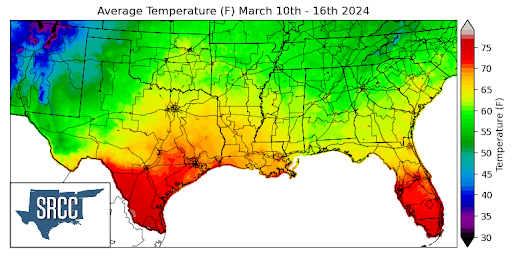
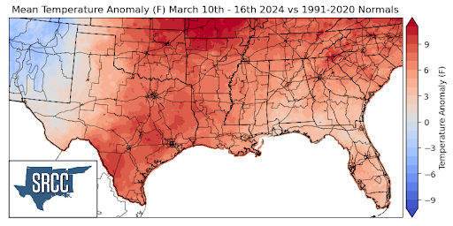
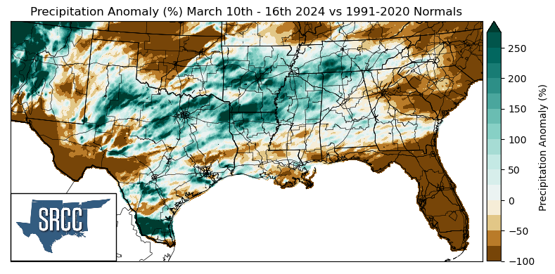
Last week the Southern Region experienced another week of above-normal temperatures. The greatest departures from normal were experienced along the Northern Arkansas border and Oklahoma where weekly average temperatures were as much as 12 degrees above normal. A cold front mid-week cooled things off though also bringing showers and severe thunderstorms along with it. Overall temperatures for the week ranged between 73 and 60 degrees Fahrenheit, with the lower bound being about 7 degrees warmer than the week prior.
Precipitation:
With the majority of the Region being in a humid subtropical climate, rainfall is common at any point of the year. Frequently, during the spring months, storm systems are common throughout the south. During March severe storm probabilities are at their highest in the Lower Mississippi Valley.
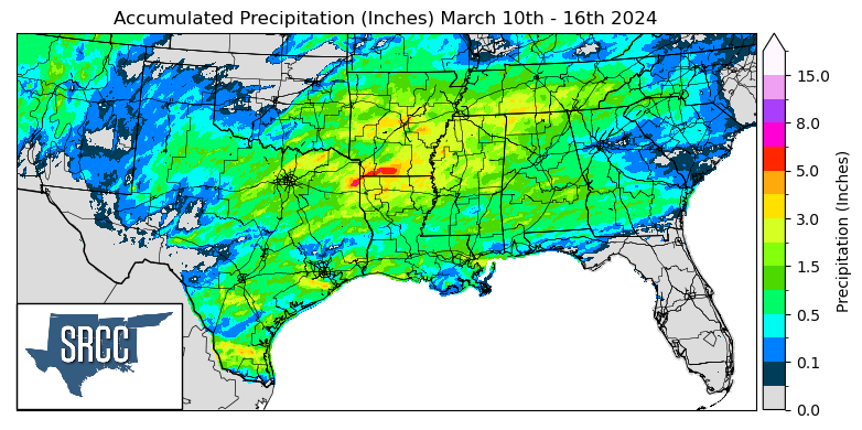
The majority of precipitation received across the Region last week occurred in the second half of the week when a low-pressure system and its associated cold and warm fronts led to storms and a strong squall line that moved through Oklahoma and Arkansas/Northern Louisiana. More rain through the weekend occurred in South Texas and Southern Louisiana as the cold front made its way south. The highest daily accumulation was seen in Southwest Arkansas where Hempstead County saw 4.59 inches of rain via a CoCoRaHS report Friday. Weekly accumulations in that area were upwards of 8 inches.