3/03/2024 - 3/09/2024
Climate in the News:
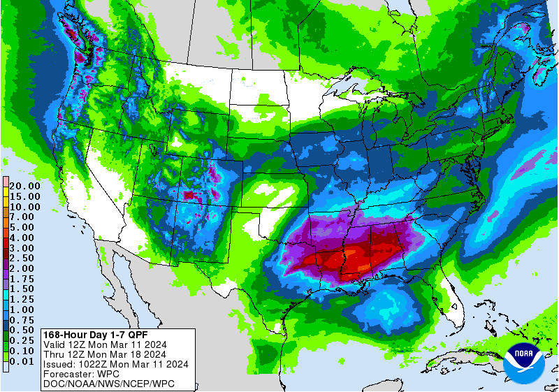
This week the Southern Region gears up for yet another week of active weather. Spring has sprung and with that means spring showers. The Weather Prediction Center’s Day 1-7 Quantitative Precipitation Forecast has the Lower Mississippi Valley receiving substantial rainfall with values as high as 5 inches across Northern Louisiana and South/Central Mississippi. Severe thunderstorms can also be anticipated in the region this week. The Storm Prediction Center currently has Northeast Texas as well as parts of Southeast Oklahoma, Western Arkansas, and Northwest Louisiana under a slight risk for severe thunderstorms this Thursday. Make sure to keep a close watch on the weather this week.
Weather Synopsis:
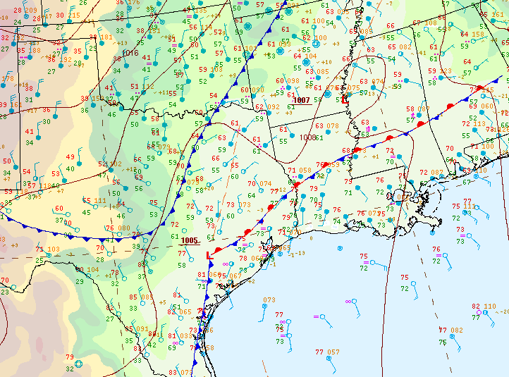
Last week’s weather pattern was very active. Most notable though, was the low-pressure system and the associated stationary boundary that dumped large amounts of rain throughout the Gulf States. It also brought hail and damaging winds.
Temperature:
Overall, March is when the Region is starting to warm up. However, frequent cold fronts are still common bringing both rain chances and below-normal temperatures for a few days.
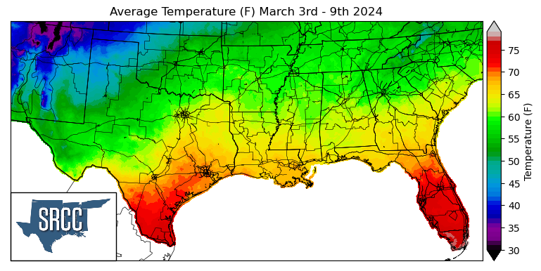
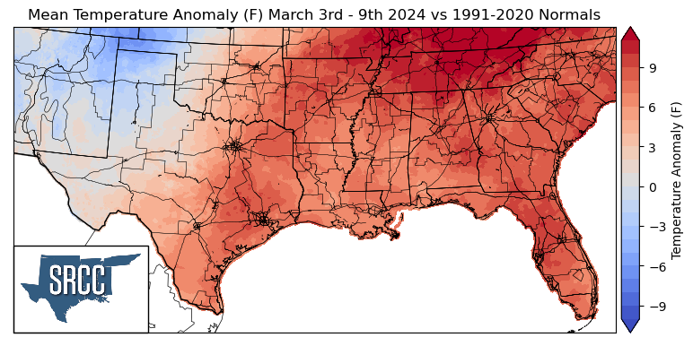
Temperatures felt spring-like as the Southern Region experienced the first full week of meteorological spring, with weekly average temperatures above normal in the majority of the Region. The greatest departures from normal were experienced in Tennessee where weekly average temperatures were as much as 12 degrees above normal. Temperatures were also especially warm in South Texas where temperatures at Hobby Airport in Houston, TX reached 83 degrees Fahrenheit, setting a new daily high temperature record for March 4th. Overall temperatures for the week ranged between 72 and 53 degrees Fahrenheit, with the upper bound being about 5 degrees warmer than the week prior.
Precipitation:
With the majority of the Region being in a humid subtropical climate, rainfall is common at any point of the year. Frequently, during the spring months, storm systems are common throughout the south. During March severe storm probabilities are at their highest in the Lower Mississippi Valley.
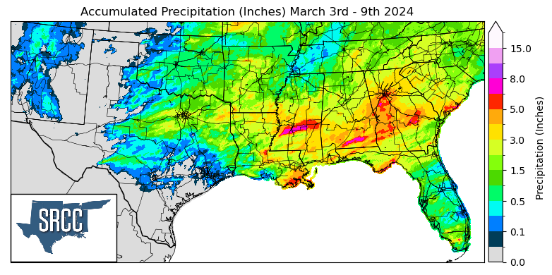
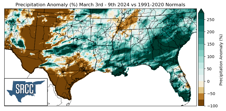
Precipitation last week was quite frequent in Louisiana, Mississippi, and Arkansas where multiple storm systems brought heavy rains. The week began with heavy rainfall and flash flooding on Monday night into Tuesday in Louisiana and Southern Mississippi. Another storm system later in the week brought storms from North Central Texas to Mississippi and Tennessee as the work week drew to a close. A cold front followed these storms, bringing with it sunny skies and cooler temperatures to begin the weekend. The highest daily accumulation was seen in the New Orleans Area where Lafourche Parish saw 4.97 inches of rain via a CoCoRaHS report Tuesday. Weekly accumulations in that area were upwards of 6.5 inches.