2/18/2024 - 2/24/2024
Climate in the News:
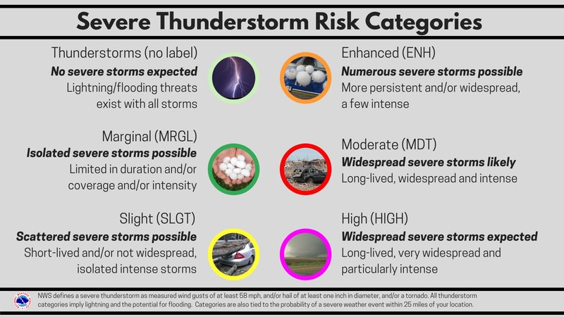
It appears the groundhog, Phil, was correct in his predictions of an early spring, but warmer temperatures also brings an earlier start to the severe weather season. This past Saturday was Severe Weather Awareness Day (SWAD). With severe weather potential this week from Michigan to Arkansas it is important to pay attention to the forecast and have a plan for weather-related warnings as we head into our peak severe weather season.
Weather Synopsis:
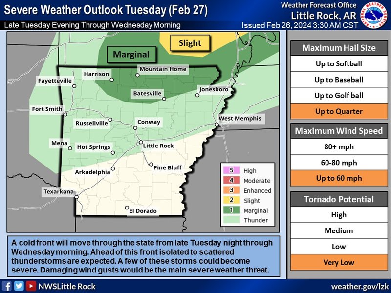
A cold front will move through the Southern Region and Arkansas on Tuesday evening into Wednesday morning. Ahead of the front in North and Central Arkansas, there is a risk for isolated showers and thunderstorms. Areas in Northern Arkansas have a chance to see an isolated severe thunderstorm.
Temperature:
Overall, February is when the Region is consistently seeing cooler temperatures. Frequent cold fronts bring with them colder air masses from the northern United States and Canada, bringing freezing temperatures to the northern portions of the Region.
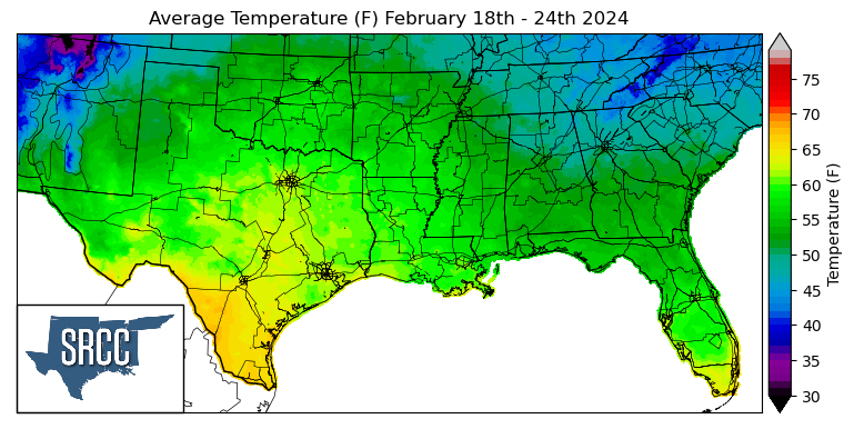
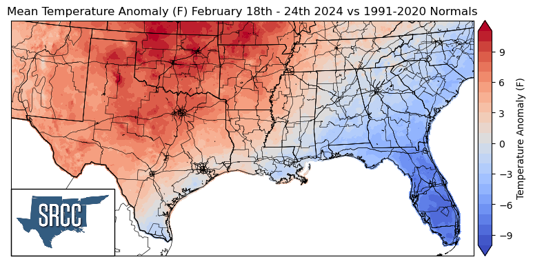
Temperatures were above normal for the majority of the Region last week with the exclusion of the coastal areas as a high-pressure system parked over the region for much of last week. The greatest departures from normal were observed in Oklahoma where weekly average temperatures were 12 degrees Fahrenheit above normal. Overall temperatures for the week ranged between 62 and 47 degrees Fahrenheit, about 7 degrees warmer than the week prior.
Precipitation:
With the majority of the Region being in a humid subtropical climate, rainfall is common at any point of the year. Frequently, during the winter months, cold fronts bring with them showers, thunderstorms, and even frozen precipitation to the Texas panhandle, Oklahoma, Arkansas, and Tennessee. The boundary between the cold and warm air masses serves as a trigger mechanism for storms.
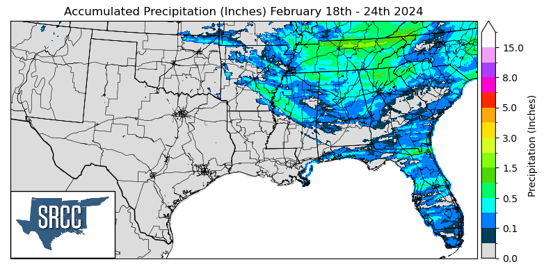
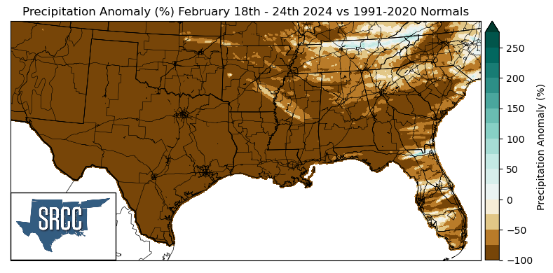
Precipitation was relatively scarce across the Southern Region last week. Upwards of an inch of rain was able to fall across Tennessee and Northern Mississippi as a weak cold front swept through the Region on Thursday night into Friday morning. Although accumulations were higher in Northern Tennessee where Smith County saw 3.75 inches of rain via a CoCoRaHS report Friday.