1/28/2024 - 2/03/2024
Climate in the News:
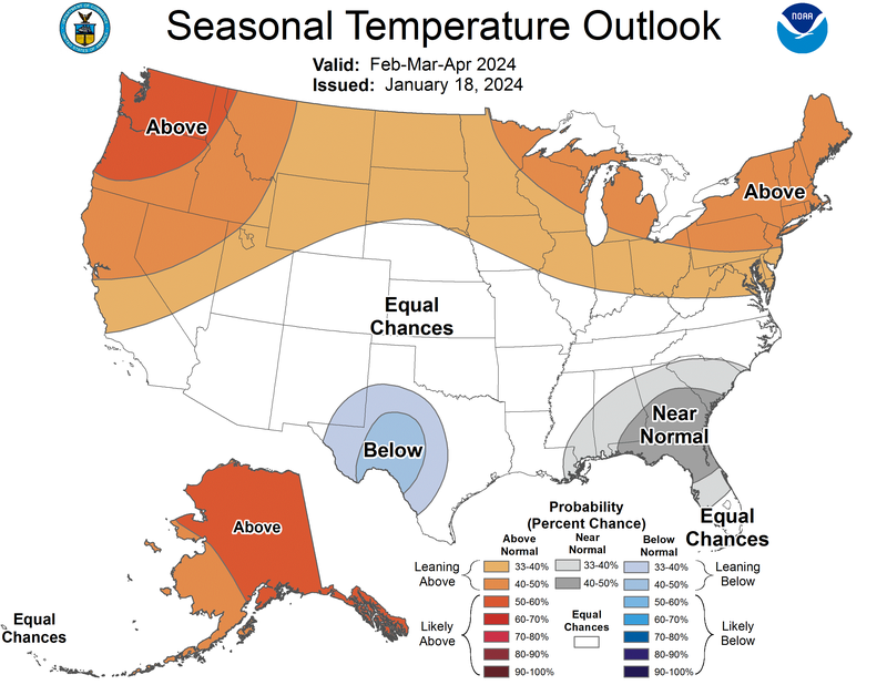
Groundhog Day occurred last week, and this year Punxsutawney Phil did not see his shadow, indicating an early spring. But, our little friend Phil has only been right about this 30% of the time in the last ten years. Consulting the professionals over at the Climate Prediction Center, a Seasonal Temperature Outlook for February through April is displayed below. Looking at this we can see the northern half of the United States is likely to experience above-normal temperatures while the lower half of the U.S., is expected to see equal chances of above-normal or below-normal temperatures, with the exclusion of Southwest Texas which is expected to see below-normal temperatures.
Weather Synopsis:
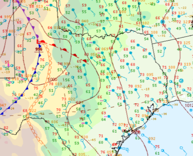
Pictured below is a surface analysis from this past Friday at 3 pm where a low-pressure system can be seen in the Texas Panhandle. The interaction between the associated warm and cold front as well as the dry line (depicted in the orange) served as a local point for thunderstorms that evening. Several occurrences of small hail were reported across the area from one inch in Vinson, OK to 1.25 inches in Childress, TX. Strong winds and one tornado also occurred, near Sagerton, TX, a damage assessment has not been conducted yet.
Temperature:
Overall, January is when the Region is consistently seeing cooler temperatures. Frequent cold fronts bring with them colder air masses from the northern United States and Canada, bringing freezing temperatures to the northern portions of the Region.
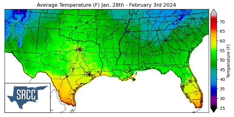
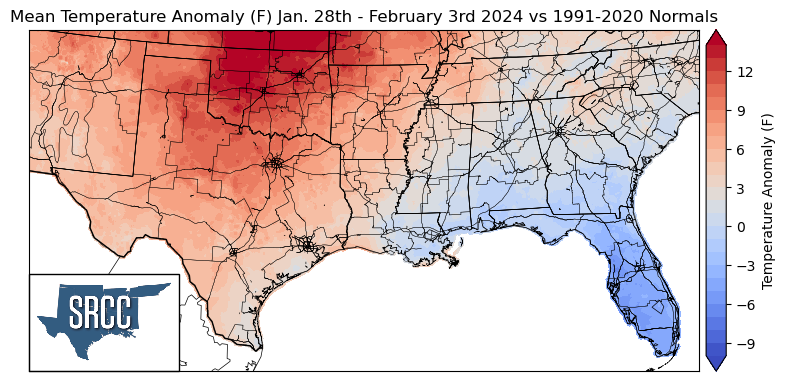
Last week the Southern Region experienced yet another week of spring-like temperatures, as an upper-level ridge dominated the weather pattern much of the week. As a result of this, weekly temperature averages were well above normal for much of the region, with Northern Oklahoma seeing temperatures as much as 15 degrees Fahrenheit above normal. Meanwhile, in the farther eastern portions of the region, weekly average temperatures were close to or slightly below normal. Overall temperatures for the week ranged between 57 and 42 degrees Fahrenheit, a slightly smaller spread than the week prior.
Precipitation:
With the majority of the Region being in a humid subtropical climate, rainfall is common at any point of the year. Frequently, during the winter months, cold fronts bring with them showers, thunderstorms, and even frozen precipitation to the Texas panhandle, Oklahoma, Arkansas, and Tennessee. The boundary between the cold and warm air masses serves as a trigger mechanism for storms.
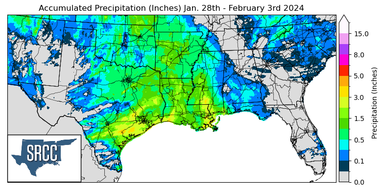
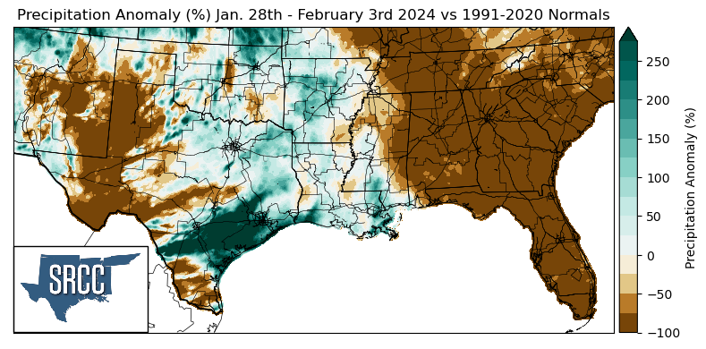
Most of the precipitation seen last week in the Southern Region was due to the low-pressure system mentioned above, otherwise, no other significant storms occurred. Southeast Texas did manage to receive above-normal amounts of precipitation from this event as the storm system moved into the area early Saturday morning. The highest daily precipitation total seen out of this system was in Northern Victoria County, TX, where 4.72 inches of rain was reported via CoCoRaHS.