12/3/2023 - 12/9/2023
Climate in the News:
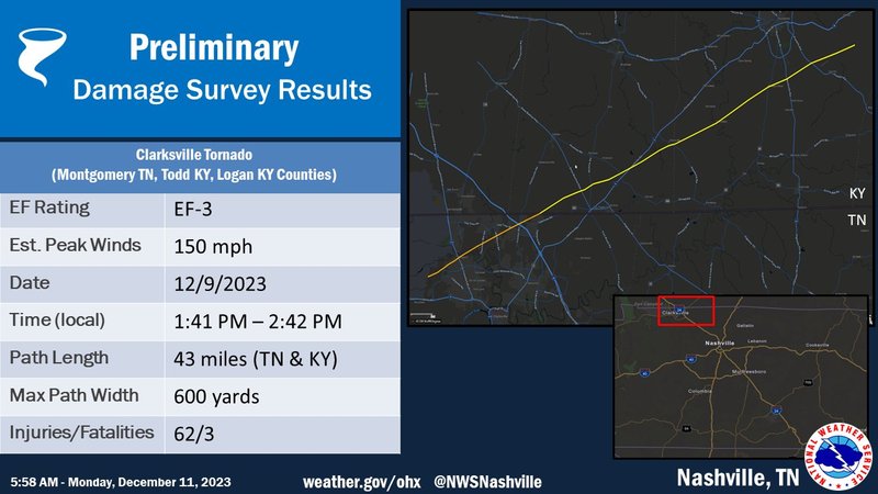
This past Saturday reminded those across the United States just how impactful weather can be. In Tennessee, a powerful EF-3 tornado ripped through the town of Clarksville, TN before traveling northeast into Kentucky. In just over one hour on the ground, this cyclone traveled 43 miles, injuring 62 people and killing 3 along the way. The damage it left behind was extensive, destroying 114 homes and damaging another 857 in Montgomery County, Tennessee alone according to Montgomery County Emergency Management.
Weather Synopsis:
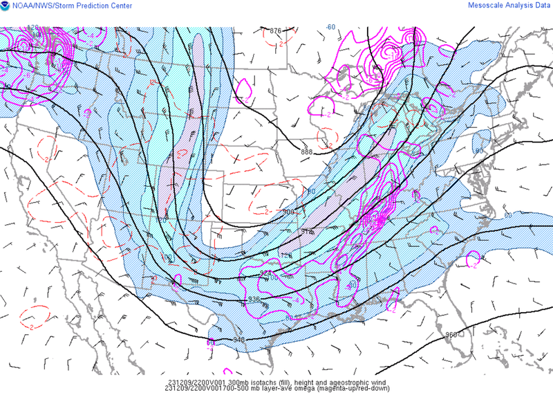
This severe weather event was conducive to the formation of tornadoes for a few reasons. Some of the most notable: low cloud bases and high levels of rotation in the wind in the lower atmosphere. The jet stream, depicted below, also played a large role on Saturday. Not only did it provide strong upper-level winds that the storms need, but the trough feature also provides a synoptic forcing mechanism for storms to grow through the depth of the atmosphere.
Temperature:
Overall, December is when most of the region starts to see cool temperatures the majority of the time as the “cool” season begins. Frequent cold fronts bring with them colder air masses from the north, bringing freezing temperatures to the northern portions of the region.
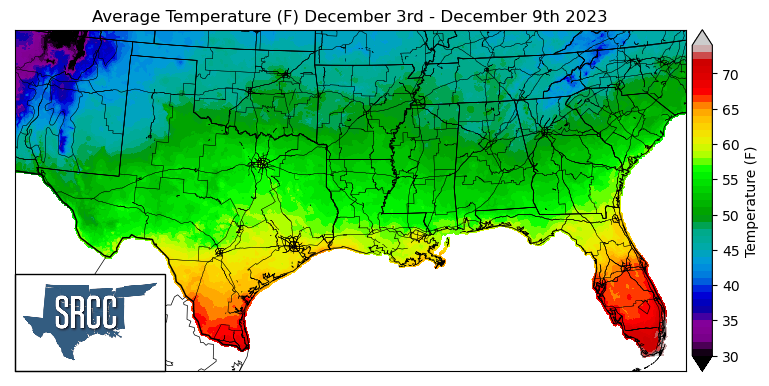
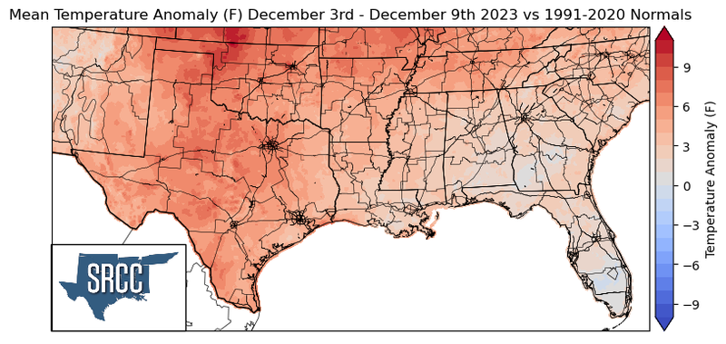
Although a cold front swept through the climate region by the weekend, but upper-level ridging throughout the southern region at the beginning of the week kept weekly average temperatures above normal. This resulted in weekly average temperatures being as high as nine degrees above normal in Northwest Oklahoma. Daily average temperatures even reached 74 degrees in the Lower Rio Grande Valley, compared to 63 degrees the week prior. Temperatures for the majority of the region last week were overall hotter everywhere and ranged between 58 to 44 degrees Fahrenheit.
Precipitation:
With the majority of the region being in a humid subtropical climate, rainfall is common at any point of the year. Frequently, during the winter months, cold fronts bring with them showers, thunderstorms, and even frozen precipitation to the Texas Panhandle, Oklahoma, Arkansas, and Tennessee. The boundary between the cold and warm air masses serves as a trigger mechanism for storms.
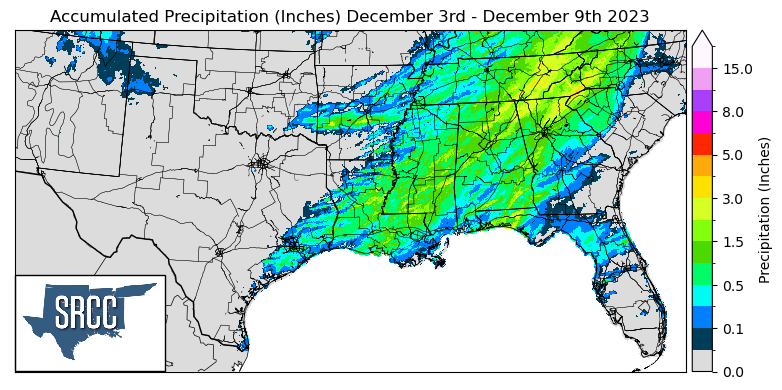
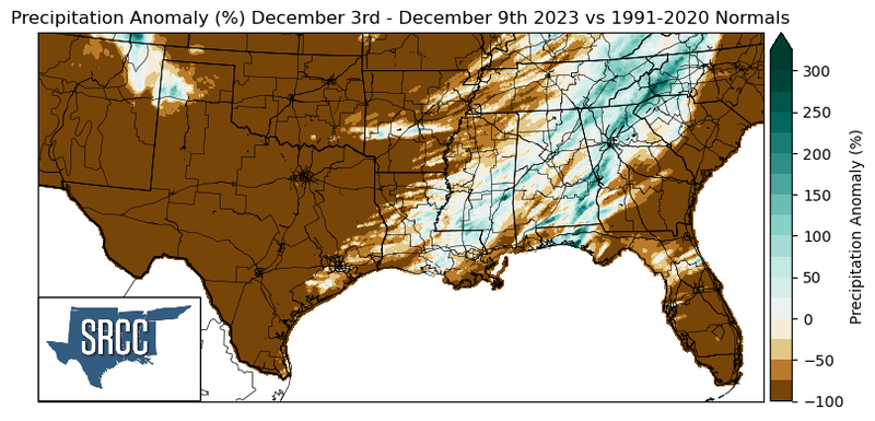
Precipitation was relatively sparse last week only occurring at a large scale by the weekend due to an advancing cold front in which a squall line advanced with it, bringing with it severe winds, damaging hail, and tornadoes. Rainfall was concentrated mainly in Tennessee, Mississippi, and Louisiana. Precipitation accumulations in Eastern Tennessee were about one and a half times greater than normal, otherwise, rainfall totals were normal or even below normal. The highest accumulation this week was seen on Saturday near Bauxite, AR where 2.24 inches of rain was reported via CoCoRaHS.
Records/Extremes:
- 12/9/2023: Yorkville, TN: EF-1 Tornado injured three people
- 12/9/2023: Clarksville, TN: EF-3 Tornado tracked for 43 miles
- 12/9/2023: Coldwater, MS: Tennis Ball sized hail reported
- 12/9/2023: Powhatan, LA: Ping Pong ball sized hail reported