12/31/2023 - 1/06/2024
Climate in the News:
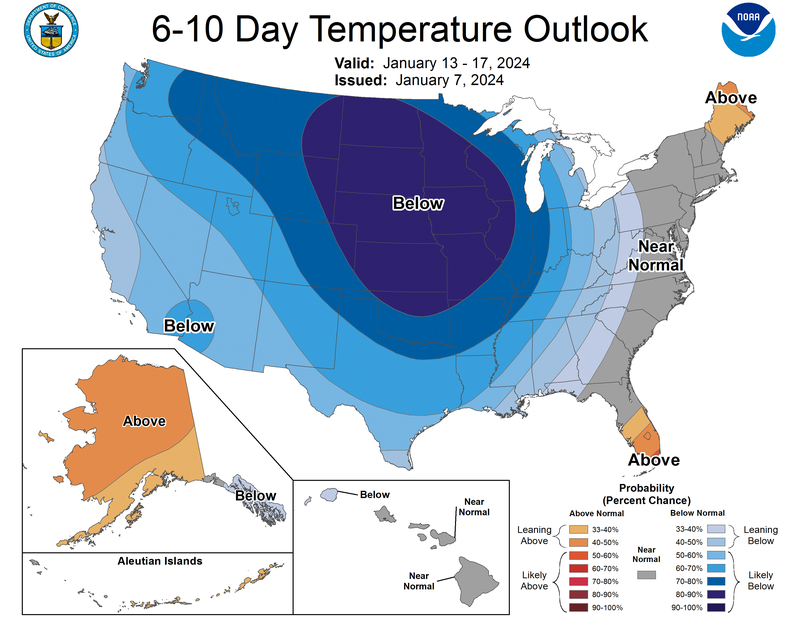
Looking ahead at the end of this week into the beginning of next week the Southern Region can expect below normal temperatures as outlined by the Climate Prediction Center’s 6-10 Day Temperature Outlook. Temperatures will become quite cold as a cold front Friday will bring with it colder air from Canada. Temperatures are forecasted to drop into the teens in Amarillo, TX and Tulsa, OK. High winds are also expected leading to possible wind chills as low as 15 degrees Fahrenheit Saturday morning in Dallas, TX.
Weather Synopsis:
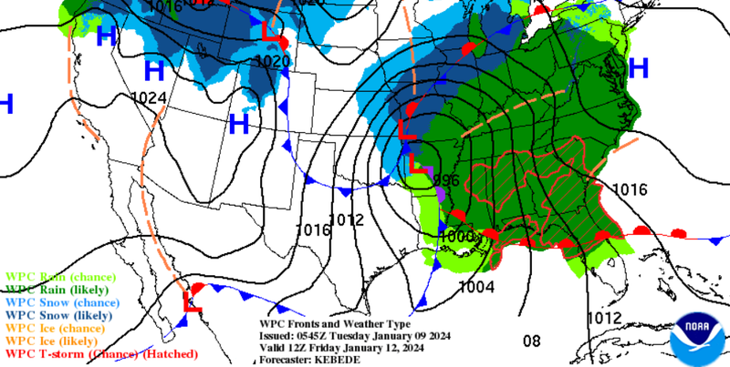
Portions of the Southern Region can also expect to see some rain along with cooler temperatures this Friday as prior to the cold front, a warm front will be moving north into Mississippi, Tennessee, and Arkansas bringing with it some showers and thunderstorms. With this system western Oklahoma has a chance for snow as temperatures behind the cold front are expected to be conducive to frozen precipitation.
Temperature:
Overall, January is when the region is consistently seeing cooler temperatures. Frequent cold fronts bring with them colder air masses from the Rocky Mountains and Canada, bringing freezing temperatures to the northern portions of the region.
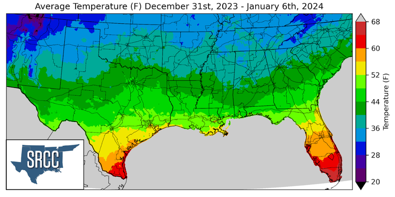
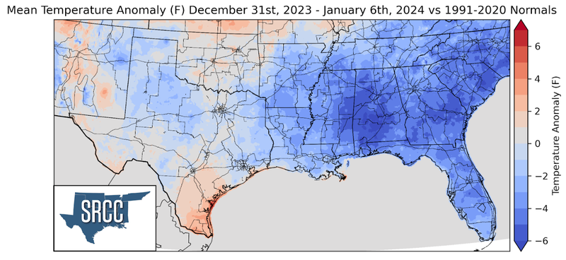
Last week most of the Southern Region experienced temperatures colder than normal as a strong cold front swept through the region at the beginning of the week, bringing a colder air mass to the south. The highest departure from normal for the week was observed in eastern Mississippi where temperatures were more than 6 degrees below normal. While Oklahoma and west Texas saw temperatures near normal. This resulted in the overall temperatures for the week ranging between 50 and 32 degrees Fahrenheit, just slightly colder than the week prior.
Precipitation:
With the majority of the Region being in a humid subtropical climate, rainfall is common at any point of the year. Frequently, during the winter months, cold fronts bring with them showers, thunderstorms, and even frozen precipitation to the Texas panhandle, Oklahoma, Arkansas, and Tennessee. The boundary between the cold and warm air masses serves as a trigger mechanism for storms.
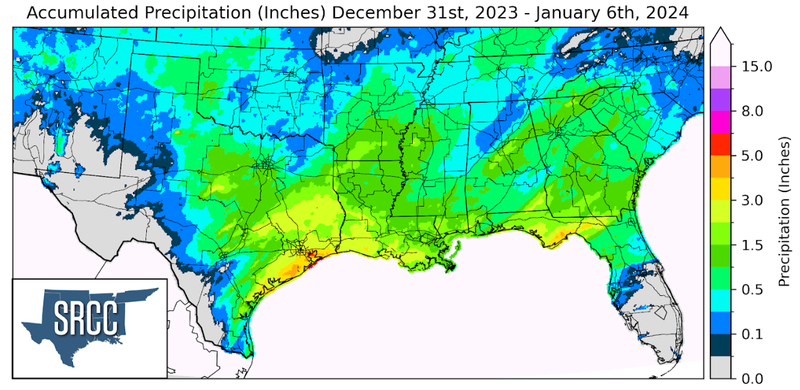
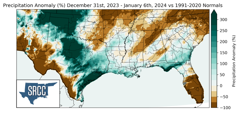
Precipitation was relatively widespread across the Southern Region last week, with the exclusion of West Texas. Small yet, three times normal precipitation accumulation in the Texas Panhandle and Western Oklahoma was due to light flurries in the area last week, as temperatures were cold enough to support frozen precipitation. Central Texas, the Brazos Valley, and areas along the Gulf Coast also experienced precipitation accumulations three times normal. This was thanks to several days of rainfall in Central Texas and sea breeze initiated showers along the coast. With the highest daily accumulation this week was seen on Friday in Brazoria County, TX where 4.18 inches of rain was reported via CoCoRaHS. But, for West Texas, Northern Arkansas, and Tennessee precipitation totals for last week were below normal.