12/24/2023 - 12/30/2023
Climate in the News:
As the new year arrived so did cooler temperatures for much of the region. Frozen precipitation, snow, sleet, and frozen rain, are not uncommon this time of year in Oklahoma, the Northern Texas Panhandle, Arkansas, and Tennessee. This week Arkansas saw some of the first flurries of the season. With winter here it is important to exercise caution on roadways during any type of frozen precipitation. Especially black ice which occurs from light freezing rain or the melting and refreezing of water or snow. Black ice is difficult to see, and the National Weather Service urges people to use caution when driving during freezing temperatures after rain or snowmelt in order to avoid an accident.

Weather Synopsis:
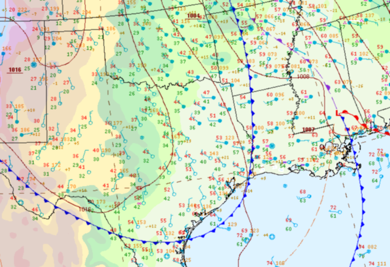
Last week began with a cold front sweeping through the southern region blowing Santa into town as it moved. Not only did this cold front bring Christmas cheer but it also brought strong winds and cooler temperatures from the Rockies cooling things down just in time for the holiday.
Temperature:
Overall, December is when most of the region starts to see cooler temperatures the majority of the time as the “cool” season begins. Frequent cold fronts bring with them colder air masses from the north, bringing freezing temperatures to the northern portions of the region.
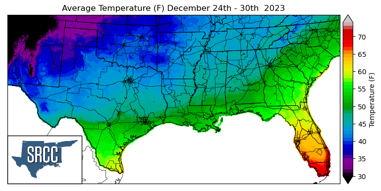
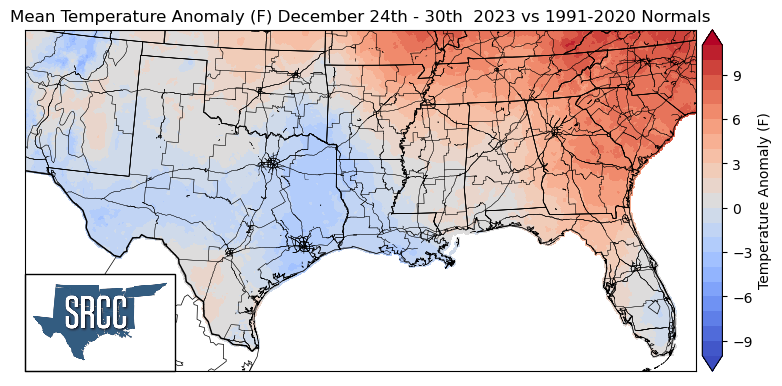
A strong cold front on Christmas Eve kept temperatures near normal and even below normal in the western half of the region, but upper-level ridging near the east coast kept temperatures above normal for the week in Tennessee and Northeast Arkansas. The highest departures from normal were observed in the Great Smoky Mountains of Eastern Tennessee where temperatures were 7 degrees above normal, while temperatures were 4 degrees below normal in the Lower Brazos Valley of South Texas. This resulted in the overall temperature for the week ranging between 52 and 35 degrees Fahrenheit, the upper bound of this being 10 degrees lower than the week prior.
Precipitation:
With the majority of the region being in a humid subtropical climate, rainfall is common at any point of the year. Frequently, during the winter months, cold fronts bring with them showers, thunderstorms, and even frozen precipitation to the Texas Panhandle, Oklahoma, Arkansas, and Tennessee. The boundary between the cold and warm air masses serves as a trigger mechanism for storms.
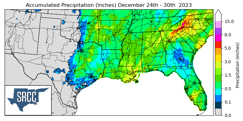
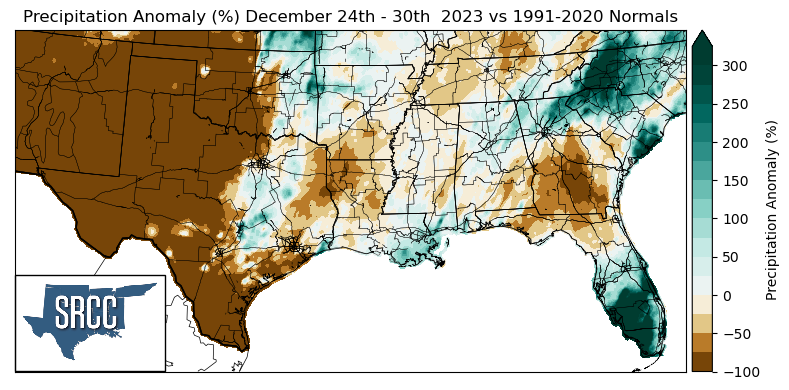
Precipitation last week was largely attributed to rain ahead of the advancing cold front on Christmas Eve, impacting holiday travel plans for many. Last week all of the western half of Texas and Oklahoma remained dry not seeing any precipitation. But, Christmas Eve rainfall in South Central Texas, Eastern Oklahoma, and Southeastern Louisiana led to precipitation totals slightly above normal. While for Northern Louisiana and East Texas, this rainfall was not enough to reach normal amounts for this time of year. The highest daily accumulation this week was seen on Saturday in Cooke County, TX where 4.75 inches of rain was reported via CoCoRaHS. But, for Arkansas, Louisiana, Mississippi, and Tennessee the four states saw an average of about 1.0 inches of precipitation for the week.