12/17/2023 - 12/23/2023
Climate in the News:
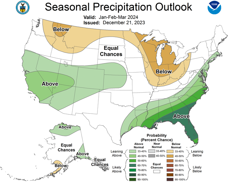
Though astronomical winter officially began this past week following winter solstice this past Thursday the southern region has been in the “cool season” for several weeks now, meaning El Niño is already affecting the Southeastern U.S. This can be seen by looking at the Seasonal Precipitation Outlook issued by the Climate Prediction Center, where for the southern region the highest probability of above-normal precipitation is in Southern Louisiana and Southern Mississippi. As far as snowfall goes, outlined in NOAA’s ENSO Blog, while it is more common during a moderate-strong El Niño in the southern states, overall climate change is leading to a slight decline in winter snowfall totals in these states.
Weather Synopsis:
Elevated amounts of precipitation in southern states were observed throughout the holiday weekend as a large-scale upper-level trough dug into Texas. This led to flooding and driving hazards as people traveled for the holidays.
Temperature:
Overall, December is when most of the region starts to see cooler temperatures the majority of the time as the “cool” season begins. Frequent cold fronts bring with them colder air masses from the north, bringing freezing temperatures to the northern portions of the region.
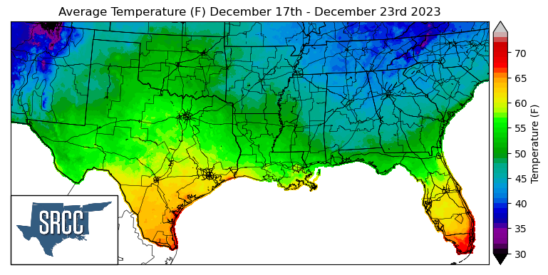
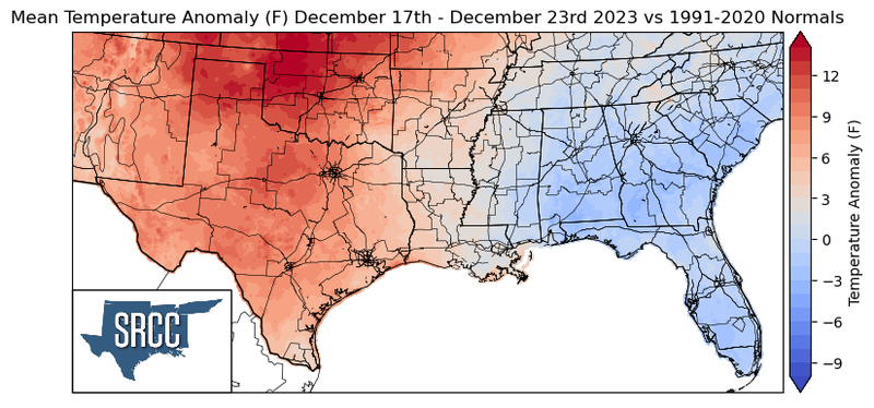
Temperatures were well above normal last week due to an upper-level ridge dominating the weather pattern for the majority of the week. The highest departures from normal were observed in Northern Oklahoma where temperatures were 15 degrees above normal, while temperatures remained closer to normal in Mississippi and Tennessee. This resulted in the overall temperature for the week ranging between 63 and 42 degrees Fahrenheit.
Precipitation:
With the majority of the region being in a humid subtropical climate, rainfall is common at any point of the year. Frequently, during the winter months, cold fronts bring with them showers, thunderstorms, and even frozen precipitation to the Texas Panhandle, Oklahoma, Arkansas, and Tennessee. The boundary between the cold and warm air masses serves as a trigger mechanism for storms.
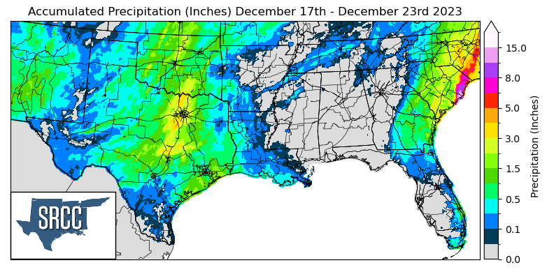
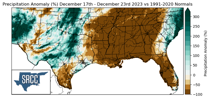
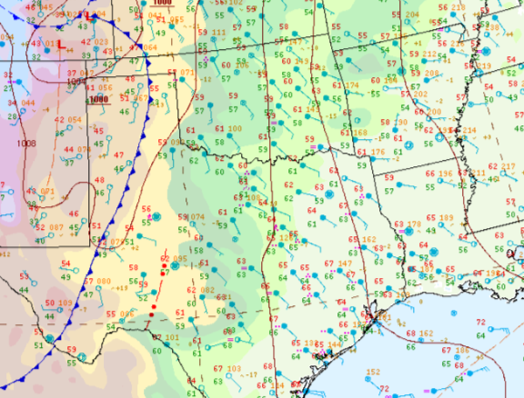
Precipitation last week was concentrated in Texas and Oklahoma, leaving the rest of the region to not see much precipitation. In North-Central Texas and Oklahoma, weekly precipitation accumulations were up to three times normal as rainfall was heavy there toward the end of the week. The highest daily accumulation this week was seen on Saturday near Denton, TX where 1.78 inches of rain was reported via CoCoRaHS. Moving farther East into the rest of the region, Arkansas, Louisiana, Tennessee, and Mississippi all saw below-normal rainfall totals last week.