1/21/2024 - 1/27/2024
Climate in the News:
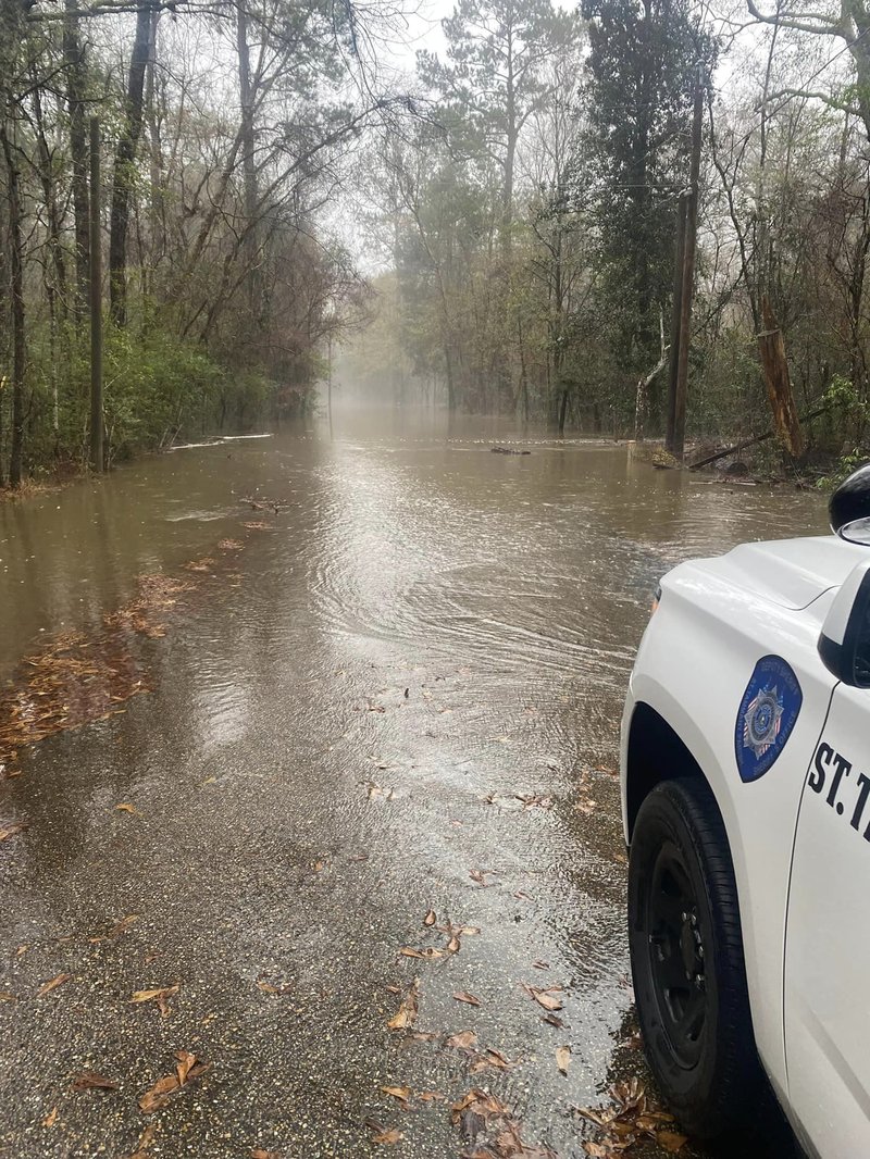
Flooding occurred across the Gulf States this week due to several days of consistent moderate and heavy rainfall. This resulted in much of Louisiana and Southeast Texas being monitored for flash flooding last week as soil conditions by the beginning of the week were already very saturated leading to additional rainfall exacerbating the ongoing runoff problem that was seen. On Wednesday NWS New Orleans reported numerous instances of flooding and impassable roads, leading to several accidents and high-water rescues. It’s important to remember to “Turn around don’t drown” as it only takes 12 inches of rushing water to lift most vehicles.
Weather Synopsis:
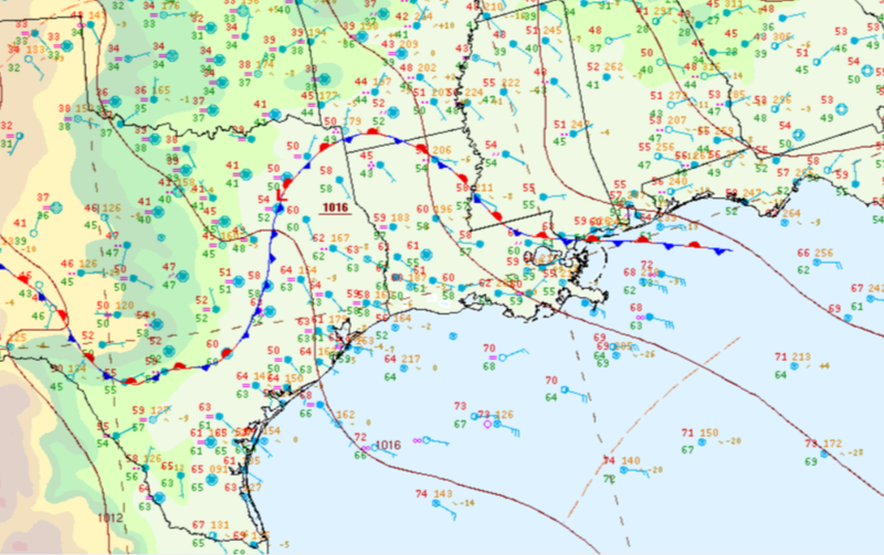
As discussed in last week's summary, rainfall last week was largely attributed to an advancing warm front which stalled Tuesday morning dumping lots of rain on the Gulf States and Southern Arkansas for a couple of days. On Thursday a cold front and associated squall line brought even more rain but left behind clearer skies.
Temperature:
Overall, January is when the Region is consistently seeing cooler temperatures. Frequent cold fronts bring with them colder air masses from the northern United States and Canada, bringing freezing temperatures to the northern portions of the Region.
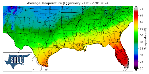
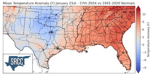
High humidity percentages as well as slight upper-level troughing led to spring-like temperatures across the United States last week. More specifically consistent rainfall and cloud cover in the southern region led to small diurnal temperature ranges due to a lack of proper radiational cooling overnight. This resulted in weekly average temperatures above normal for the eastern half of the region, while temperatures were slightly below normal or near normal in Texas and Oklahoma. Overall temperatures for the week ranged between 60 and 38 degrees Fahrenheit, with the upper bound of this being about 20 degrees higher than the week prior.
Precipitation:
With the majority of the Region being in a humid subtropical climate, rainfall is common at any point of the year. Frequently, during the winter months, cold fronts bring with them showers, thunderstorms, and even frozen precipitation to the Texas panhandle, Oklahoma, Arkansas, and Tennessee. The boundary between the cold and warm air masses serves as a trigger mechanism for storms.
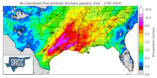
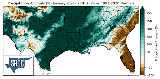
Last week the Southern Region saw significant amounts of precipitation leading to flash flooding and high water levels in streams, creeks, and rivers. The majority of Southeast Texas, Louisiana, Mississippi, and Southern Arkansas all saw at least 8 inches of rainfall last week. Yet some areas in Texas saw that in one day in Washington County, TX, several CoCaRaHS stations reported over 8 inches of precipitation on Thursday, with one station even recording 9.10 inches of rain. All last week's rainfall also led to Austin, TX seeing its second wettest January on record. Significant amount of precipitation is expected to have improved drought in the southern region significantly in the past week so make sure to check back on Thursday for our weekly drought update.