12/10/2023 - 12/16/2023
Climate in the News:
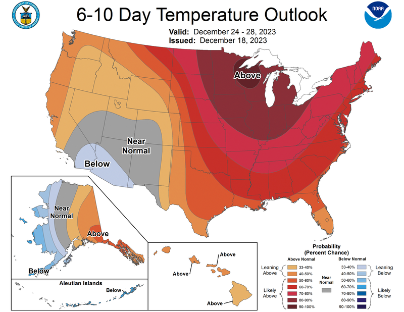
Displayed below by the 6-10 Day Temperature Outlook, by the Climate Prediction Center, shows that much of the United States is expected to experience above-normal temperatures for the holidays. Therefore, a white Christmas is not in the forecast for the southern climate region. Although, the National Weather Service does anticipate a chance for showers and thunderstorms on Christmas day from Oklahoma eastward to Tennessee. So, keep an eye on the forecast as we get closer to next Monday to plan your travel accordingly.
Weather Synopsis:
A stationary front that stalled in the Texas Panhandle and Western Oklahoma brought significant rain to the northwest portion of the climate region last Wednesday into Thursday. During last week much of this area saw at least 3 inches of rain and up to 5 inches southeast of Amarillo, TX.
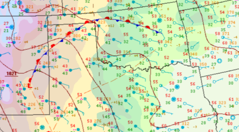
Source: Weather Prediction Center, 12/13/23, 1pm
Temperature:
Overall, December is when most of the region starts to see cooler temperatures the majority of the time as the “cool” season begins. Frequent cold fronts bring with them colder air masses from the north, bringing freezing temperatures to the northern portions of the region.
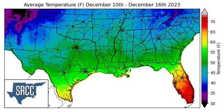
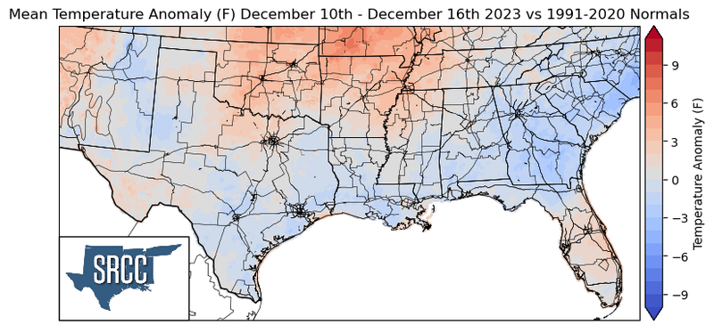
Last week the upper level pattern changed quite frequently, the southern region saw troughing, ridinging, all affecting the week's temperatures. Slightly above normal temperatures were observed in Oklahoma, Arkansas, and Western Tennessee last week, with the highest departure from normal seen in Northern Arkansas where temperatures were an average of 5 degrees above normal. Near normal temperatures were observed in the Texas Panhandle, Far West Texas, Central Texas, and Central Tennessee, and central Mississippi. Finally, temperatures were slightly below normal in South Texas and Louisiana. The overall temperature spread for the region was relatively small ranging between 55 and 42 degrees Fahrenheit.
Precipitation:
With the majority of the region being in a humid subtropical climate, rainfall is common at any point of the year. Frequently, during the winter months, cold fronts bring with them showers, thunderstorms, and even frozen precipitation to the Texas Panhandle, Oklahoma, Arkansas, and Tennessee. The boundary between the cold and warm air masses serves as a trigger mechanism for storms.
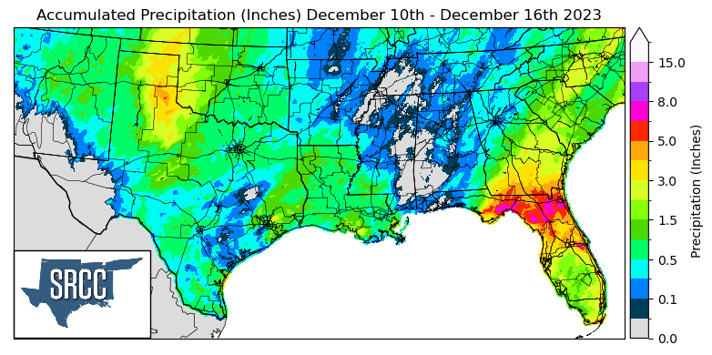
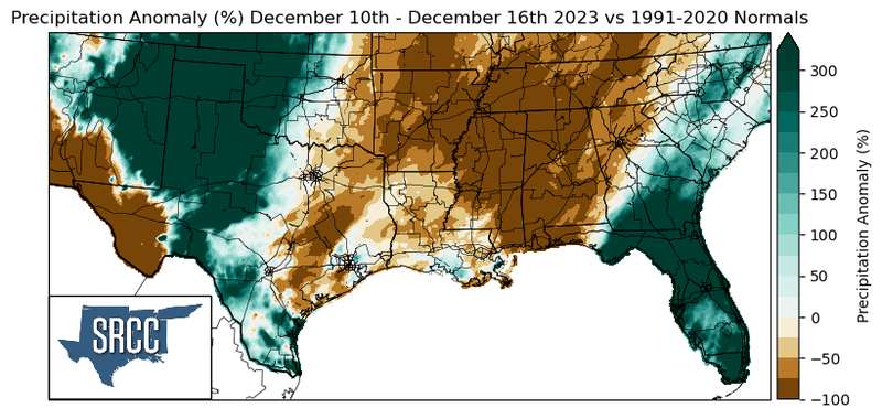
Precipitation last week was concentrated in the Northwest of the climate region last week, with the rest of the region seeing an inch or less of rainfall. In the Texas Panhandle into Western Oklahoma, weekly precipitation accumulations were three times normal as rainfall was fairly consistent there this week. The highest daily accumulation this week was seen on Thursday in Beaver County, OK located in the Oklahoma Panhandle where 2.31 inches of rain was reported via CoCoRaHS. Moving farther East into Central Texas and Central Oklahoma rainfall was near normal, while Far West Texas, Arkansas, Tennessee, Louisiana, and Mississippi all saw below normal rainfall totals last week.