11/19/2023 - 11/25/2023
Climate in the News:
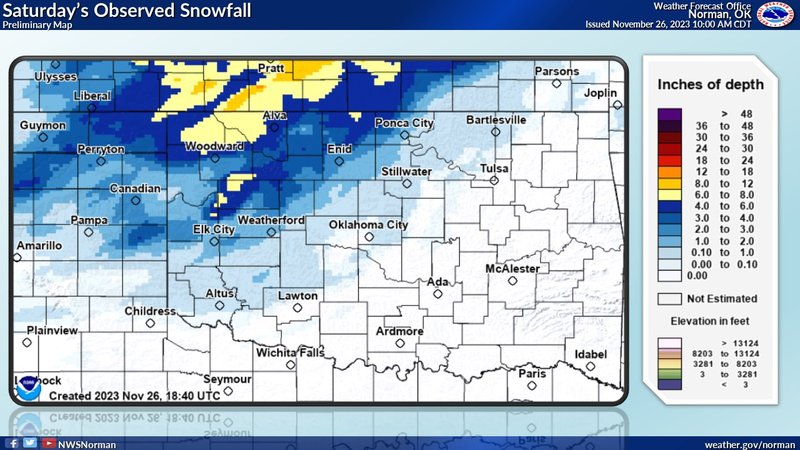
The northern portions of Texas and Oklahoma saw significant accumulation of snow for the first time this season. Northwest Oklahoma saw the largest accumulations, in Buffalo, Oklahoma 7.8 inches of snow was measured, the highest in the state! As the climate region starts to experience cooler temperatures and winter precipitation events it is important to know how to be prepared for this weather. The National Weather Service emphasizes the importance of dressing in layers as temperatures continue to drop as we move towards winter. They also have a list of recommended items to prepare for a winter storm, such as a flashlight, extra batteries, a NOAA Weather Radio, extra food and water, first-aid supplies, heating fuel, and an emergency heating source.
Weather Synopsis:
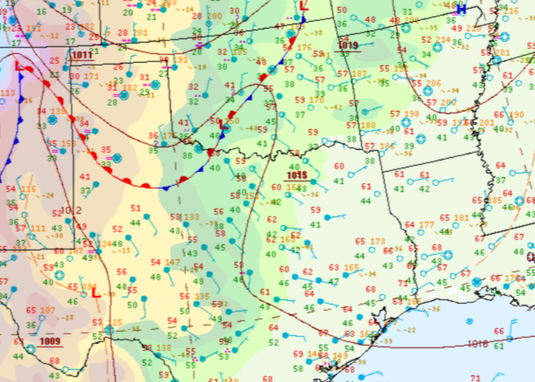
Snowfall in the northern Texas panhandle and Northwest Oklahoma was led by an advancing warm front into the region, where the warm moist air mass rides up over the cool dry air mass, lifting the air, leading to rain, and in this case snow. Also seen in the surface analysis below, the rest of the region is in a broad region of high pressure with surface winds coming from the south, keeping temperatures relatively seasonal for the end of last week.
Temperature:
Overall, November is when most of the region starts to see temperatures cooling down significantly. Frequent cold fronts bring with them colder air masses from the north.
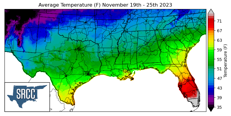
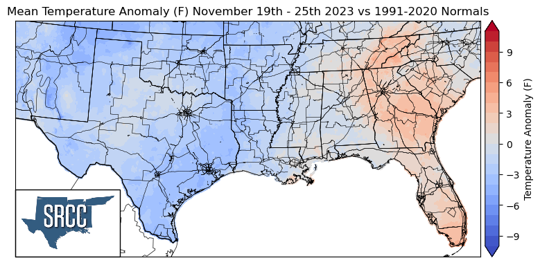
A cold front swept through the southern region Monday into Tuesday leaving behind cool and dry conditions for the Southern Region. Due to this strong cold front, temperatures were well below normal all across the central plains into the southern region. Daily average temperatures for the week were between 6 to 8 degrees Fahrenheit below normal in the Panhandle region and Southeast Texas, leading the Southern Region to start feeling like winter late this November. Along the northern states of the region, the daily average temperature sat around 42 degrees. The temperature for the majority of the region ranged between 60 to 45 degrees Fahrenheit, with the lower bound of this range being about 10 degrees lower than the previous week.
Precipitation:
With the majority of the region being in a humid subtropical climate, rainfall is common at any point of the year. Frequently, during the fall months, cold fronts bring with them showers and thunderstorms. The boundary between the cold and warm air masses serves as a trigger mechanism for storms.
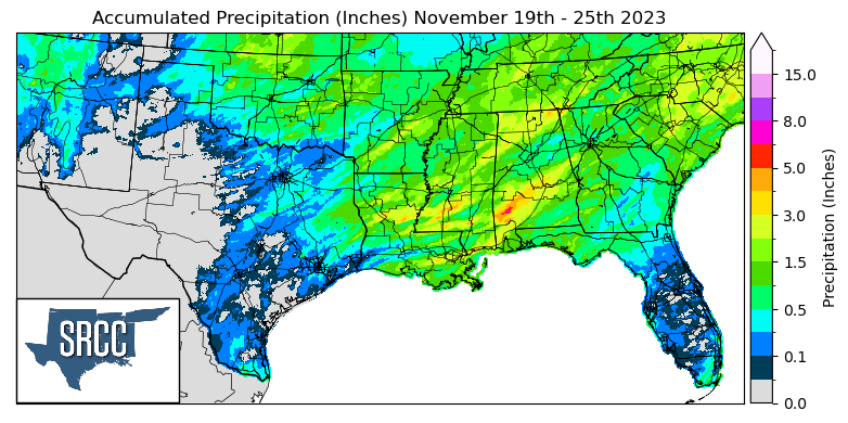
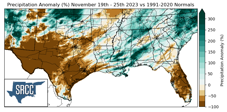
The majority of the precipitation seen last week was due to an advancing cold front early in the week. As discussed in Last week's summary, East Texas, Louisiana, and Mississippi were at risk for severe thunderstorms. This cold front had a squall line along it as it moved eastward through the region. Not only did these storms bring heavy winds, but they also brought heavy rain as flash flood warnings were observed in Louisiana and Mississippi Monday night. This brought much-needed rain to a swath of exceptional drought (D4) in Louisiana and South Central Mississippi. The weekly accumulated precipitation for the week in this region was 1.5 to as much as 4.5 inches in Southern Mississippi. It is also worth noting that the snowfall received in Northwest Oklahoma on Saturday led to precipitation accumulations three times normal for last week.
Records/Extremes:
- 11/20/2023: Clayton, LA: 1.75 inch hail reported
- 11/20/2023: Gorum, LA: EF-1 Tornado
- 11/20/2023: Marskville, LA: Long track 23 mile EF-1 Tornado
- 11/20/2023: Gluckstadt, MS: 60 mph wind gust associated with a severe thunderstorm.
- 11/20/2023: Shoccoe, MS: EF-1 Tornado