05/18/2025 - 05/24/2025
Climate in the News:
A state of emergency was declared in Washington County, Arkansas, on Monday. An EF-1 tornado caused significant damage to the area past midnight. The Arkansas Democrat-Gazette reports that most neighborhood roads were closed due to downed trees, power lines, and damage to a large transmission line. Poweroutage.us reported over 30,700 electric customers were left without power on Monday night in Washington and Madison counties. Fortunately, no injuries or fatalities resulted. Powerful thunderstorms also produced tornadoes in Oklahoma and Nebraska on Monday.
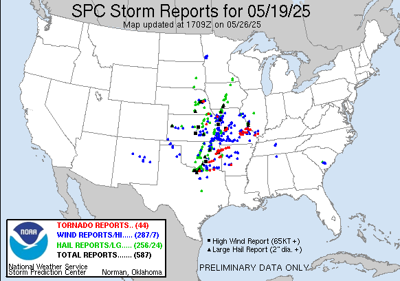
Storms reported on Monday, May 19th, 2025, throughout the contiguous U.S. Source: spc.noaa.gov
Weather Synopsis:
The most impactful weather of the week took place on Monday when a line of strong thunderstorms formed along a dryline draped across Oklahoma and Texas in a north-south orientation (pictured below). Storms moved repeatedly over North Texas, south-central Oklahoma, and western Arkansas from the early afternoon into midnight. Atmospheric conditions allowed storms to produce softball-sized hail in Texas, destructive 80+ mph winds in Oklahoma, and at least five tornadoes in Arkansas, Texas, and Oklahoma, according to preliminary reports.
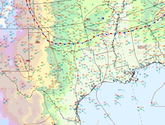
Source: WPC Surface Analysis, 5/19/25 at 4pm CDT
Temperature:
Generally, May is when the Region starts to see consistently warmer temperatures. Temperatures in the southern portions of the Region often start seeing daily average temperatures in the low 80s.
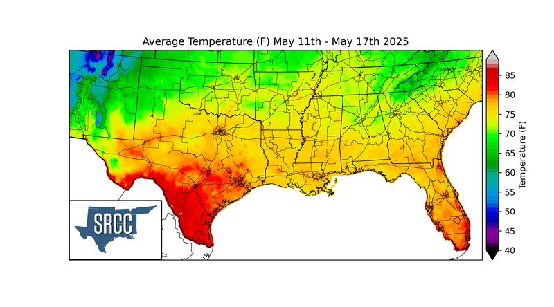
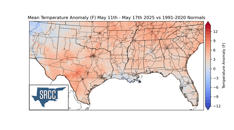
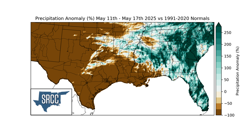
Last week, temperatures were seasonal across the Southern Region. A succession of low-pressure systems set a consistent boundary between cooler and warmer air just north of the Region. As a result, cloud cover and rainfall cooled temperatures south of the boundary in Oklahoma, Arkansas, Tennessee, Mississippi, and Texas, and the greatest negative temperature anomalies occurred in the northern edges of those states. South of this boundary, daily average temperatures rose and are starting to reach summer-like temperatures. Overall, weekly average temperatures hovered around 65 to 85 degrees Fahrenheit for much of the Region.
Precipitation:
With most of the Region located in a humid subtropical climate, rainfall occurs at any point of the year. During the spring months, storm systems are frequent throughout the South. In May, severe storm probabilities are at their highest in Oklahoma and Northeast Texas in the Southern Region.
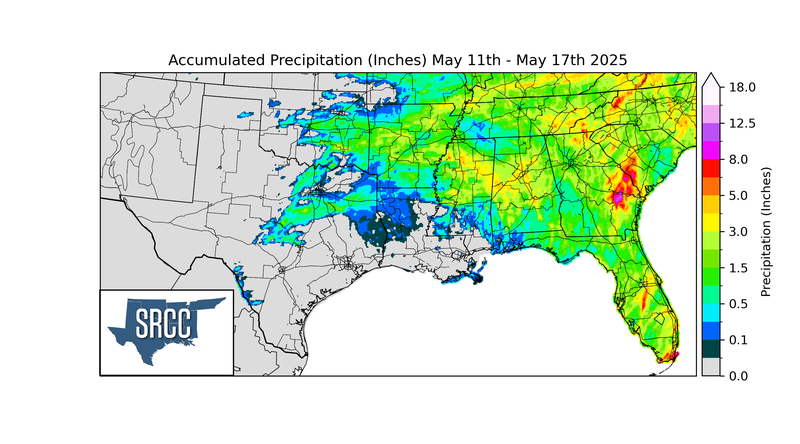
The previously mentioned low-pressure systems were responsible for much of the rainfall in the Southern Region last week. Storms also fired and strengthened by interacting with boundaries created by rain-cooled air. These mechanisms for thunderstorms resulted in rainfall across the Region, with most areas receiving at least 0.5 inches. Precipitation totals were the highest in Daisy, Oklahoma, where 7.90 inches of rain fell last week.