05/04/2025 - 05/10/2025
Climate in the News:
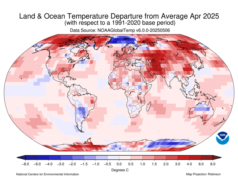
According to the latest report from NOAA’s National Centers for Environmental Information, 2025 was the second-warmest April globally and second-warmest January-April period since records began in 1850. For North America, however, 2025 was not as drastic. This continent had its 5th warmest April and 8th warmest January-April on record this year.
Weather Synopsis:
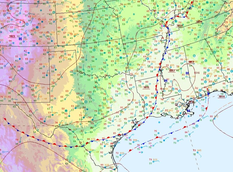
Strong lines of thunderstorms formed on Thursday along a stationary front draped across the Southern Region, dipping into South Texas and extending northward to eastern Tennessee. Storms reportedly produced 1-inch to 3-inch hailstones in Tennessee, Texas, and Mississippi. Severe wind gusts of 75 mph to 115 mph also occurred in southeast Texas.
Temperature:
Generally, May is when the Region starts to see consistently warmer temperatures. Temperatures in the southern portions of the Region often start seeing daily average temperatures in the low 80s.
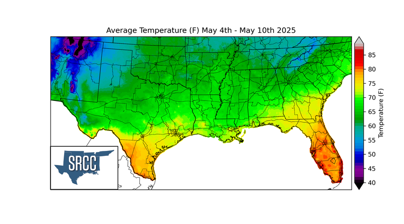
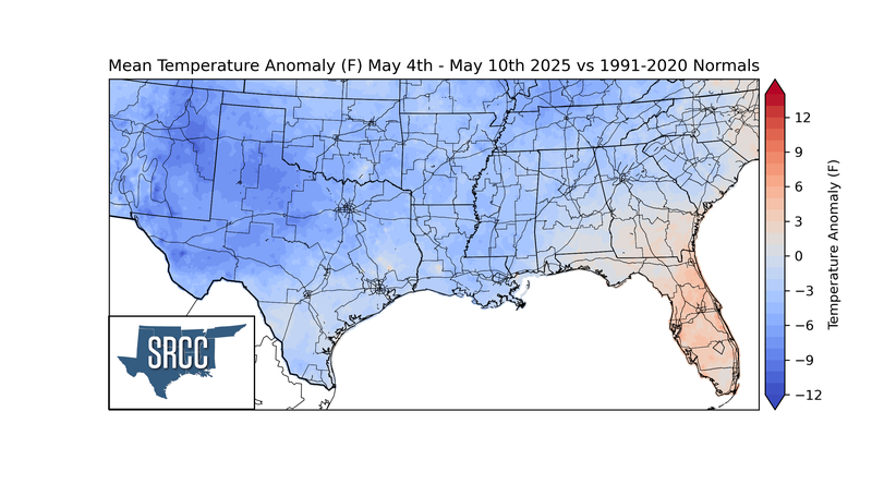
Last week, temperatures were mild across the Southern Region. A consistent flow of air from the north resulted in cooler-than-average temperatures across the Region. The largest negative temperature anomalies occurred in west Texas. Overall, weekly average temperatures hovered around 60 to 80 degrees Fahrenheit for much of the Region.
Precipitation:
With most of the Region located in a humid subtropical climate, rainfall occurs at any point of the year. During the spring months, storm systems are frequent throughout the south. In May, severe storm probabilities are at their highest in Oklahoma and Northeast Texas in the Southern Region.
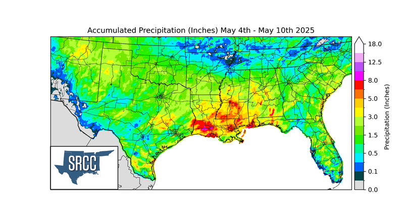
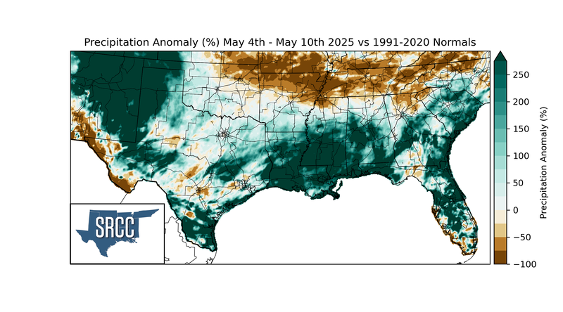
The previously mentioned stationary front was responsible for much of the rainfall in the Southern Region last week. Storms also fired due to a disturbance across the front that formed a low-pressure system and migrated eastward. These two mechanisms for thunderstorms resulted in plentiful rain in Louisiana, Mississippi, the panhandles, and portions of Texas last week, with most areas receiving at least 1.5 inches. Precipitation totals were much higher in Louisiana and Mississippi, where over 8 inches of rain fell last week.