04/27/2025 - 05/03/2025
Climate in the News:
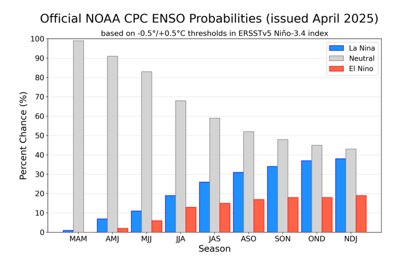
According to the latest report from NOAA’s Climate Prediction Center, the current La Niña has officially come to an end. This La Niña event was very short-lived, lasting only about 6 months. Looking to the future, ENSO-Neutral conditions are expected to prevail through summer 2025, with a greater than 50% chance of sticking around through the Fall as well.
Weather Synopsis:
Widespread showers and thunderstorms formed on Friday along a stationary front that was draped across the Southern Region. Overnight storms also left behind outflow boundaries which triggered further showers and thunderstorms.
Temperature:
Overall, April is when the Region starts to see consistently warmer temperatures. However, regular cold fronts are still common, bringing both increased chances of rain and below-normal temperatures for a few days.
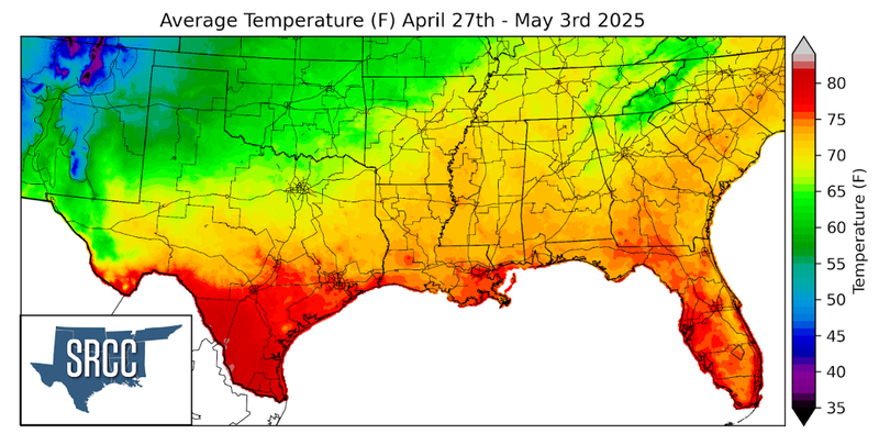
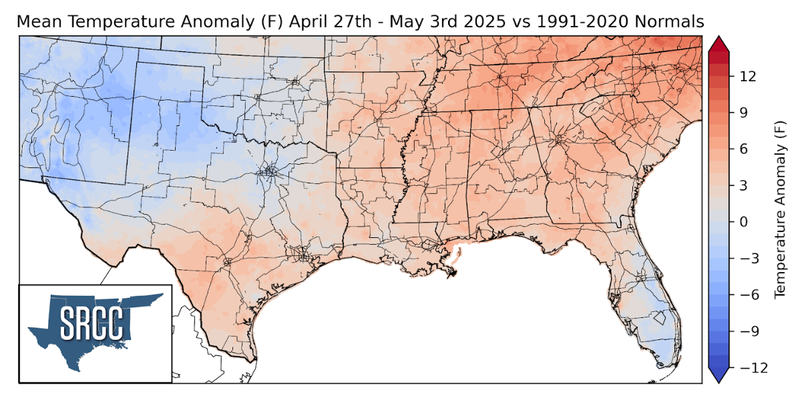
Temperatures were mild, yet muggy across the Southern Region last week. Consistent onshore flow from the Gulf resulted in frequent cloud cover and a high surface moisture content. Due to this, no significant temperature anomalies were observed last week. Overall, weekly average temperatures hovered around 65 to 75 degrees Fahrenheit for much of the Region.
Precipitation:
With much of the Region being in a humid subtropical climate, rainfall is common at any point of the year. During the spring months, storm systems are common throughout the South. During April severe storm probabilities are at their highest in Oklahoma and Northeast Texas.
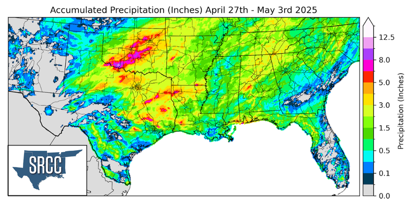
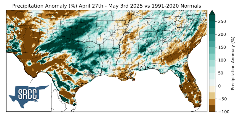
The previously mentioned stationary front was responsible for much of the rainfall in the Southern Region last week. Additionally, storms also fired along the dryline in West Texas before growing and moving into North-Central Texas and Oklahoma. These two mechanisms for thunderstorms resulted in plentiful rain across the Region last week, with most areas receiving at least an inch. Precipitation totals were much higher near the Red River in Oklahoma, where ten inches of rain was recorded last week.