04/20/2025 - 04/26/2025
Climate in the News:
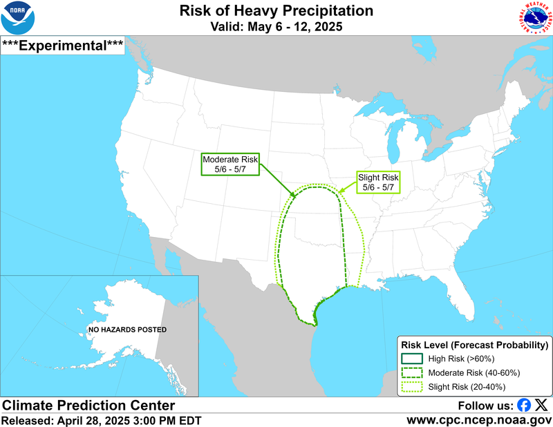
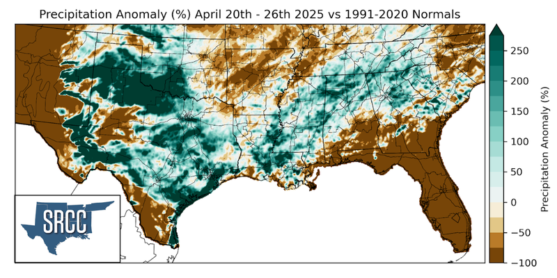
Saturated soils are present in parts of the Southern and Central Plains as well as the Middle and Lower Mississippi River Valley. Rainfall is forecast to continue in this region through the next 7 days. An additional risk of heavy precipitation for parts from the Central and Southern plains is renewed next week. This could lead to new or continued flooding, especially in areas with already saturated or near-saturated soils. Thus, there is a moderate risk of heavy precipitation from Texas to Kansas.
Weather Synopsis:
On Easter Sunday a strong cold front passed through the Southern Region. Associated with this cold front was a strong line of storms, called a “squall line”.
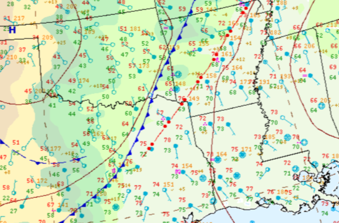
Source: WPC Surface Analysis, 4/20/25 at 4pm CST
Temperature:
Overall, April is when the Region starts to see consistently warmer temperatures. However, regular cold fronts are still common, bringing both increased chances of rain and below-normal temperatures for a few days.
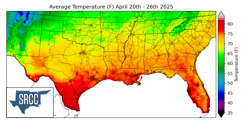
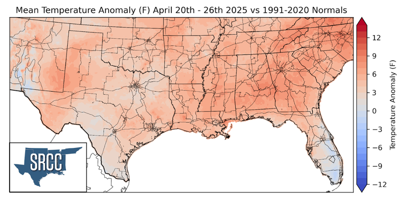
Temperatures were slightly above normal for much of the Southern Region last week. The largest departure from normal was observed in eastern Tennessee where weekly average temperatures were about 5 degrees above normal. Overall, weekly average temperatures hovered around 65 to 75 degrees Fahrenheit for much of the Region.
Precipitation:
With much of the Region being in a humid subtropical climate, rainfall is common at any point of the year. During the spring months, storm systems are common throughout the South. During April severe storm probabilities are at their highest in Oklahoma and Northeast Texas.
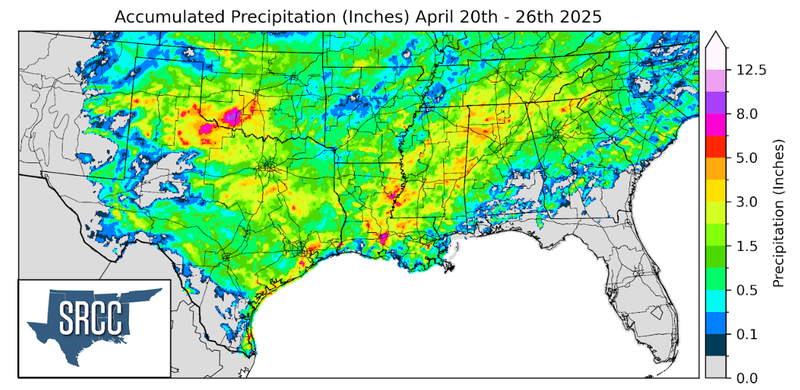
Precipitation was plentiful last week, with many spring storms showers. The week began with storms pushing through with a strong cold front. Throughout much of the week, several days of severe thunderstorms occurred in West Texas as storms fired along the dryline. Overall, much of the Region saw at least an inch of precipitation last week, with areas nearing the Red River seeing upwards of eight inches.