04/13/2025 - 04/19/2025
Climate in the News:
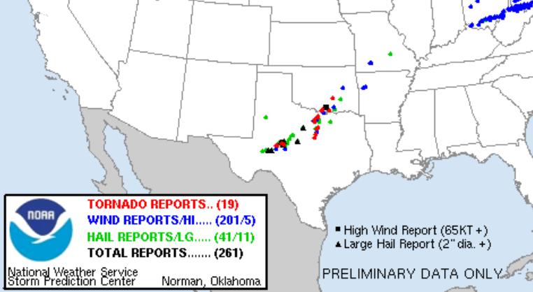
Saturday evening in West Texas several severe storms popped up and produced a couple tornadoes and hail greater than two inches in diameter. Overnight storms moved into the Dallas-Ft. Worth Metroplex where several more tornadoes were reported. So far damage surveys from the National Weather Service have revealed 3 EF-0’s, 4-EF-1's, and 1 EF-2.
Weather Synopsis:
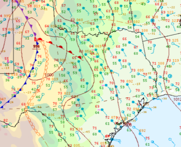
These severe storms formed along a stationary front in the Hill Country. Severe storms also fired at the intersection of the front and the dryline, this is called a triple point.
Temperature:
Overall, April is when the Region starts to see consistently warmer temperatures. However, regular cold fronts are still common, bringing both rain chances and below-normal temperatures for a few days.
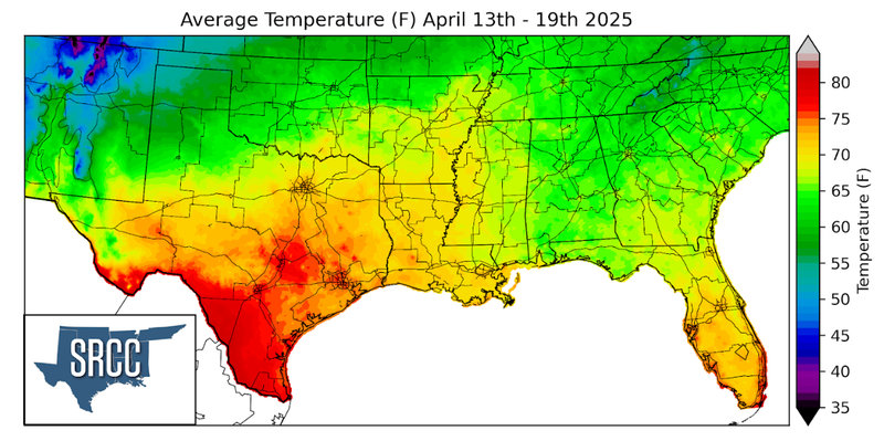
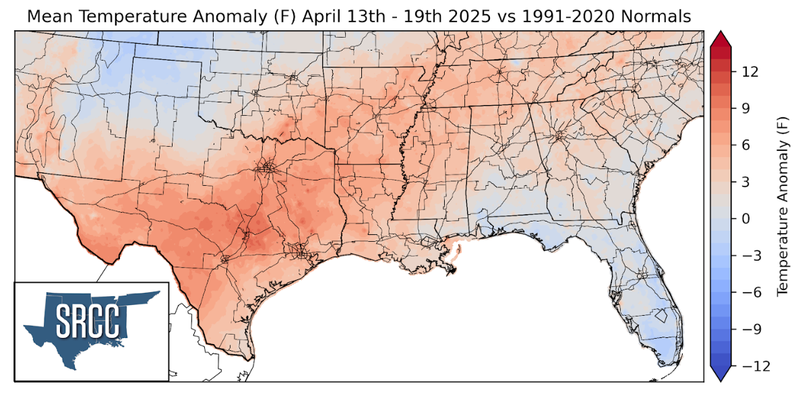
Temperatures were slightly above normal for much of the Southern Region last week. The largest departure from normal was observed near Austin, Texas where weekly average temperatures were about 7 degrees above normal. Overall, weekly average temperatures hovered around 65 to 72 degrees Fahrenheit for much of the Region, several degrees warmer than last week.
Precipitation:
With the majority of the Region being in a humid subtropical climate, rainfall is common at any point of the year. During the spring months, storm systems are common throughout the South. During April severe storm probabilities are at their highest in Oklahoma and Northeast Texas.
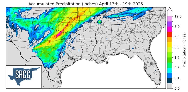
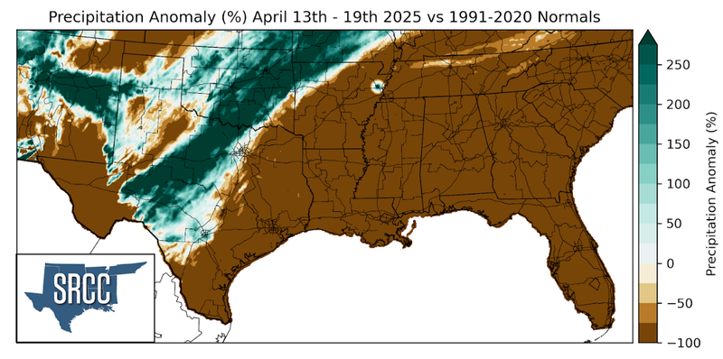
The Southern Region was dry outside of rainfall received from storms on Friday and Saturday. The most rainfall occurred Saturday night as several storms fired along the stationary boundary. Flash flooding occurred in West Texas where storms would consistently track over the same location. The highest accumulations occurred near Bowie, Texas where precipitation totals were as much as eight inches.