8/31/2023
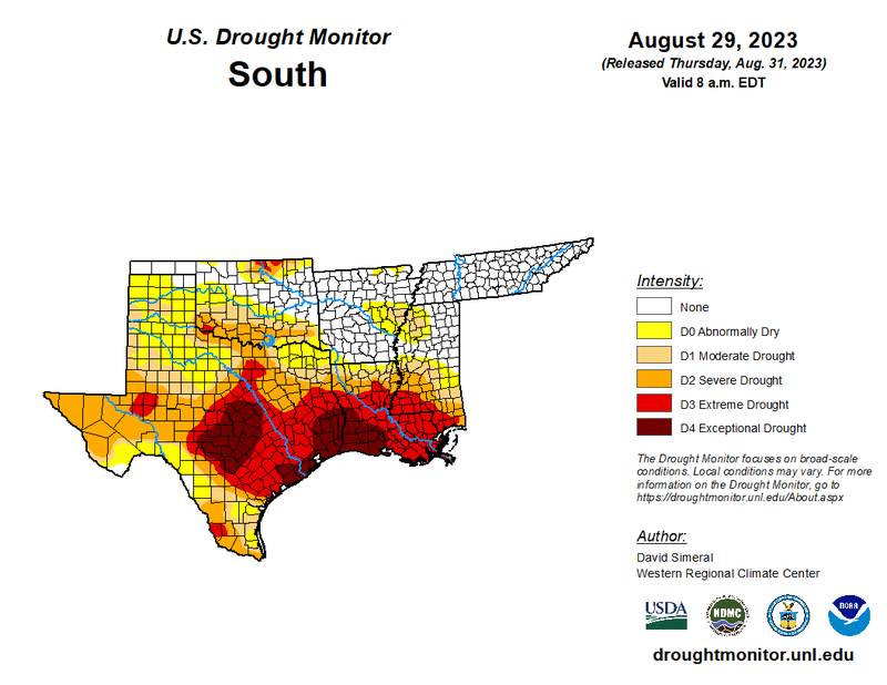
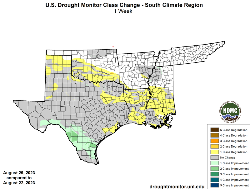
Extreme heat and dry conditions throughout the majority of the climate region in the past week have led to worsening drought conditions across several states. The Texas Panhandle, Louisiana, southern Mississippi, and southern Oklahoma were all anomalously warm last week and lacked a significant amount of precipitation. Due to these conditions, widespread one-class degradations were experienced in these areas of the climate region. Thankfully, though a frontal passage on Sunday brought scattered showers and thunderstorms to a large portion of Central Texas, keeping drought conditions from worsening. Evidence of Tropical Storm Harold is quite clear, as it brought one- and two-class improvements to South Texas, eliminating drought in some areas. However, while drought was able to improve in some portions of Texas, it has continued to worsen in Louisiana, where 21% of the state is experiencing D4 drought conditions, the highest of any U.S. state, and 74% of the state is experiencing D3-D4 drought conditions.
Looking into the future, as outlined by the Climate Prediction Center's Day 8-14 U.S. Hazards Outlook, the majority of the climate region is at risk for some level of excessive heat. Along with that, The Texas Panhandle, Central Oklahoma, the ArkLaTex region, and Central Mississippi are outlined in a “Rapid onset Drought Risk”.