2/01/2024
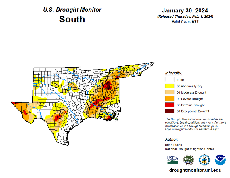
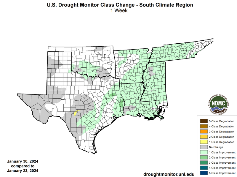
Overall the Southern Region was cool and very wet last week. Most notably, the ArkLaTex region saw widespread one-class improvements, and two-class improvements over east Texas. Precipitation in East Texas this past week led to the amelioration of drought in most of the region. Rain throughout the day on January 23rd brought 3 to 5 inches of rain to east Texas and west Arkansas. Hail-producing storms moved through ArkLaTex that evening, causing flash flooding throughout the area. Precipitation continued until January 25th with highest accumulations recorded in east Texas. A low pressure system moving across the Southern Region added to the weekly precipitation totals overnight Friday and Saturday. Similar conditions brought precipitation and one-class improvements to Mississippi and Tennessee. However, northwest Mississippi remained in exceptional Drought (D4) conditions throughout this month. The area has received slightly above normal rainfall over the past 30 days, yet counties there continue to experience long-time water shortages.
In Texas, east of the I-35 corridor in San Antonio and Austin saw hazardous road conditions due to rushing water in roadways on January 22nd from continuous moderate to heavy rain starting from the night before. Thirty-one of Austin’s low-water crossings were closed that morning due to flooding. Several lines of thunderstorms brought moderate to heavy rainfall, which prolonged existing flooding and brought new flash flood warnings until Thursday. According to CoCoRaHS reports over those 96 hours, Fayette County received the most precipitation, 13.06 inches, as of Thursday morning. This resulted in a one-class improvement throughout the coastal plains.