12/07/2023
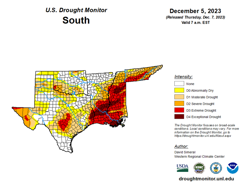
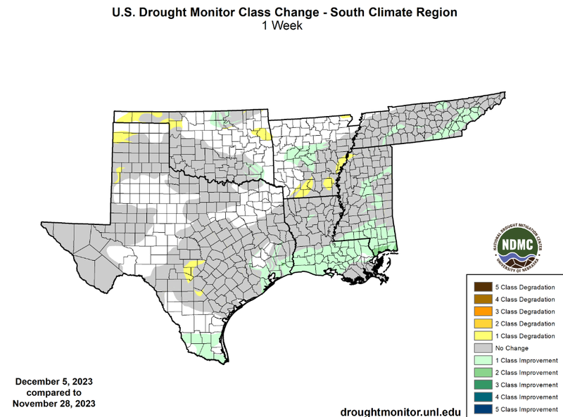
Overall, temperatures in the southern region for the past week have been below or near normal with moderate precipitation totals. However, a low-pressure system and its associated cold/warm front led to large accumulations of rain from the night of November 30th into the morning of December 1st. These large accumulations in areas that needed it the most led to widespread one-class improvements in Southern Louisiana and South Mississippi. Other drought improvements were also experienced in South Texas, parts of Oklahoma, Central Arkansas, and Tennessee. Rainfall last week was relatively widespread, but in West Texas precipitation was scarce resulting in some one-class degradations of drought in the Panhandle region. This rainfall across the southern Gulf states has led to the intensity of drought decreasing significantly. With areas experiencing exceptional drought (D4) in the southern region, it dropped from 10% of the region on November 28th, down to 5% on December 5th.
Looking into the future, as outlined by the Climate Prediction Center’s One Month Precipitation Outlook, valid for December, above-normal precipitation chances are expected in Louisiana and Mississippi, which can be expected with a strong El Nino. This should help prevent worsening drought conditions in the two states and even improve drought conditions.