1/18/2024
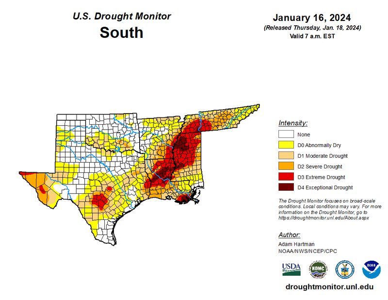
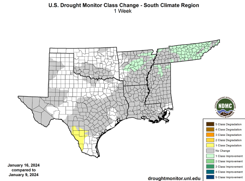
Last week’s series of low-pressure systems brought one-class improvements throughout East-Central Tennessee, Central Arkansas, and counties in Northern Mississippi. The Nashville area received 6.3 inches of snowfall this Monday, January 15th, which broke the daily snowfall record. Including Sunday's snowfall of 1.3 inches, the Nashville area received 7.6 inches and the Knoxville, TN area received 8.5 inches of snow last week! This, along with more than one inch of rain on Friday and Saturday (January 12th and 13th), contributed to drought improvements across the state. Meanwhile, in Arkansas, Boone County received the most amount of snowfall in the state, 4 inches, during the weekend.
Despite these improvements, more rainfall is still needed to combat long-term precipitation deficits and to rejuvenate groundwater supplies. The Memphis area, Jackson area, Shreveport area, New Orleans area, as well as West and Central Texas continue to experience extreme drought conditions. Parts of South Texas have not received precipitation this January, with the exception of some areas receiving less than .05 of an inch on Monday (January 15th). Therefore, a one-class degradation was observed this week. Overall due to above-normal precipitation and cold temperatures last week, drought conditions remained unchanged across the region.
The next spell of arctic air, freezing wind chills, and wintry precipitation is knocking on our region’s door, as a weak system ushers in freezing temperatures. The National Weather Service has forecasted precipitation in Eastern Tennessee tonight into tomorrow, and the majority of the southern region will experience cooler temperatures starting tomorrow and throughout the weekend.