11/22/2023
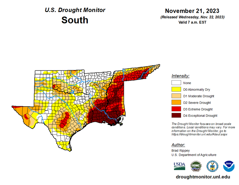
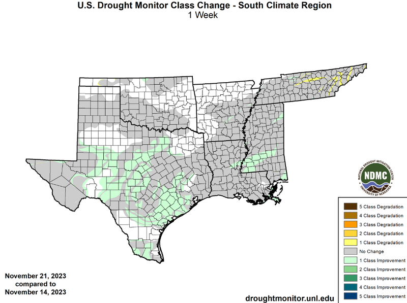
While temperatures were above normal for the majority of the region last week, the southern region experienced another week with moderate precipitation accumulations. But, this past Monday a surface low-pressure, with associated cold and warm fronts led to large amounts of rain and thunderstorms from Monday morning in East Texas to late Monday night in Mississippi. Many flash flood warnings occurred in Mississippi with the advancing cold front leading to daily precipitation totals as high as 4 inches in Southern Mississippi. Rain last week and storms early this week led to widespread one-class improvements in Texas and even improvement of D4 drought conditions to D3 in Southern Mississippi. Tennessee continued to lack significant rainfall last week resulting in one-class degradations in Northeastern Tennessee. Overall these widespread improvements in Texas and Mississippi have led to the contraction of areas experiencing drought in the southern region, from 78% of the region on November 14th, to 76% on November 21st.
Looking into the future, as outlined by the U.S Seasonal Drought Outlook, valid for November 16th through February 29th, drought is not expected to worsen in any portion of the climate region, thanks to enhanced amounts of precipitation brought about by a strong El Nino. However, drought is expected to persist in Northern Tennessee and West Texas.