04/11/2024
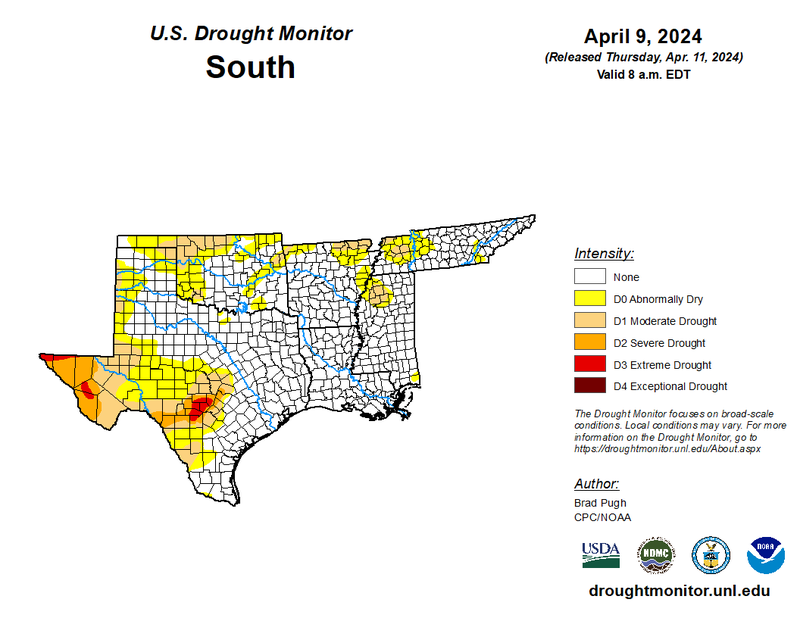
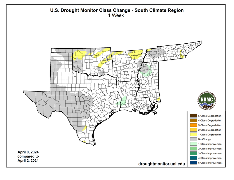
Last week was active with severe thunderstorms and seasonably high temperatures over the Southern Region. Record high minimum temperatures broke throughout Tennessee, south Texas, and some parts of Arkansas and Mississippi on April 2nd, which allowed the environment that day to produce significant rainfall - especially north of the Texas panhandle. High temperatures and severe thunderstorms returned over most of the Southern Region on Monday. As a result, Shreveport, LA, received a new daily rainfall record of 3.81 inches - 1.2 inches more than the previous record set in 1942. Both events contributed to drought improvements and amelioration in the Texas-Louisiana border and northwest Mississippi.
Despite concentrated rainfall, most northern portions of the Southern Regions received one-classification degradations in drought. As low pressure systems developed last week, it brought high winds that eroded topsoil moisture in already abnormally dry areas in Oklahoma, Arkansas, and Tennessee. The expansion of (D0) Abnormally Dry land area in south Texas, and the development of it in southern Mississippi, occurred due to lack of rainfall over the past month.
Looking to the future, the Climate Prediction Center’s Seasonal Drought Outlook is forecasting drought improvements for most of the Texas Hill Country by the end of June. The area is under (D3) Extreme Drought, currently the worst category experienced by the Southern Region.