04/04/2024
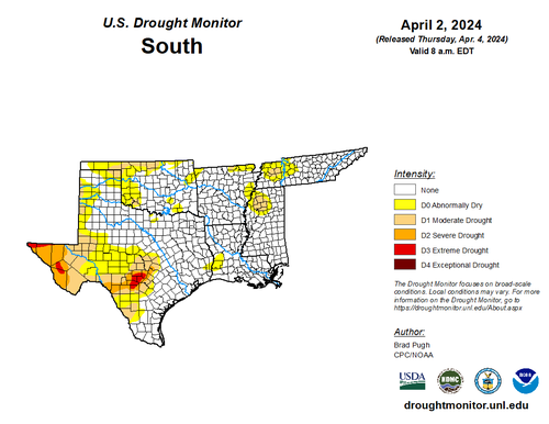
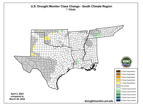
The biggest drought influencer last week was above normal temperatures and the April 1st severe weather event. Rainfall was scattered from central Oklahoma and eastward, initiated by a dry line and a cold front. Most notably, the Tupelo, Mississippi area received 1.44 inches of rainfall during the April first through second severe weather event, and the Tulsa, Oklahoma area received 1.01 inches of rain. As a result, much of Oklahoma and parts of Texas and Mississippi received higher than normal rainfall, ameliorating drought in northern Oklahoma, Tennessee, and western Louisiana. Most of the Southern region was also hotter-than-normal. While some parts of west Texas received above average rainfall during this day this was not widespread. Abnormally dry conditions continued to expand in areas that have not received significant rainfall since the middle of March, resulting in one class degradation northwest of the Southern Region.
Looking months into the future, the odds of El Nino transitioning to ENSO-neutral is increasing, along with odds of La Nina developing over the summer, according to the Climate Prediction Center. For the Southern Region, this means for an active Hurricane season, and any storm’s remnants may bring abundant moisture and rainfall to most of the area.