03/28/2024
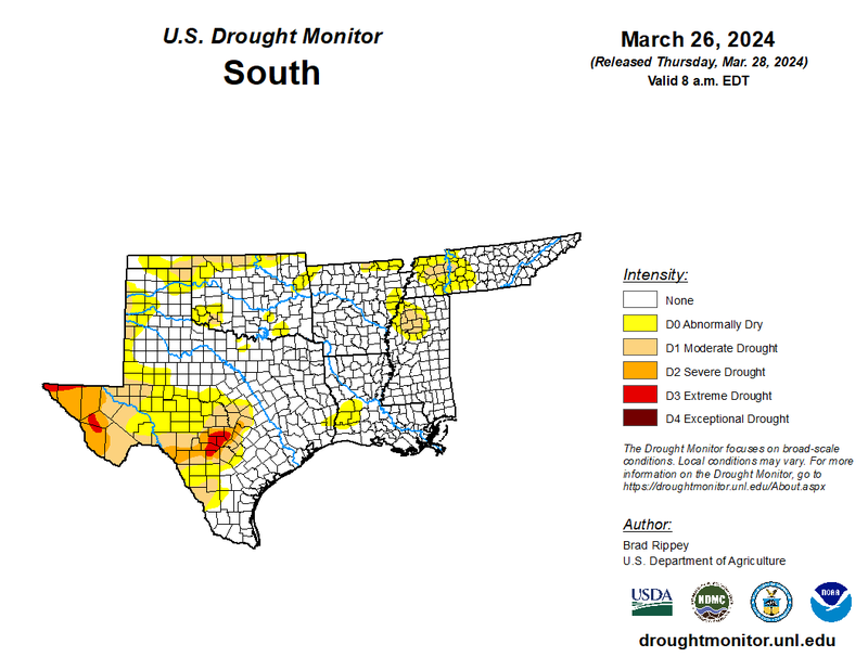
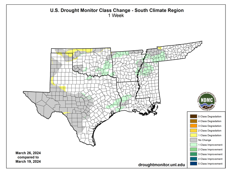
Last week was a severe weather week for most of the Southern Region, caused by seasonable temperatures and higher relative humidity values. As moisture is carried in from the Gulf of Mexico, boundaries in temperature and moisture initiated storms in east Texas panhandle, Oklahoma and south and eastward, producing hail and tornadoes. While most of the areas impacted are not affected by drought, it brought localized improvements in Oklahoma. Little precipitation fell in the panhandle due to strong, dry winds. This continues to be the theme throughout the western portion of the Southern Region, where severity of drought increased to (D1) Moderate Drought conditions throughout northern Oklahoma. (D0) Abnormally Dry areas continue to expand in Texas, where drought-affected areas became prone to critical fire threats. The next day, lines of storms brought widespread one-classification improvements to the eastern portion, as it initiated from the I-35 corridor and moved eastward. It produced 1.8 inches of rainfall in Arkansas, 2.31 inches of rain in Louisiana, 2.83 inches of rainfall in Mississippi, and .70 inches of rain around Nashville, Tennessee. As a result, the Southern Region affected by drought has decreased significantly, contributing to an overall ten percent decrease in the month of March.
Looking to the future, April is looking to become a hotter-than-normal and wetter-than-normal month due to El Nino’s effects for the Southern Region. The Climate Prediction Center’s 30-Day Forecast depicts this most likely to occur as west as central Oklahoma, and as east as central Tennessee. The Texas panhandle and west Texas are left out, as this area has equal chances of above or below normal temperatures and precipitation.