08/31/2025 - 09/06/2025
Climate in the News:
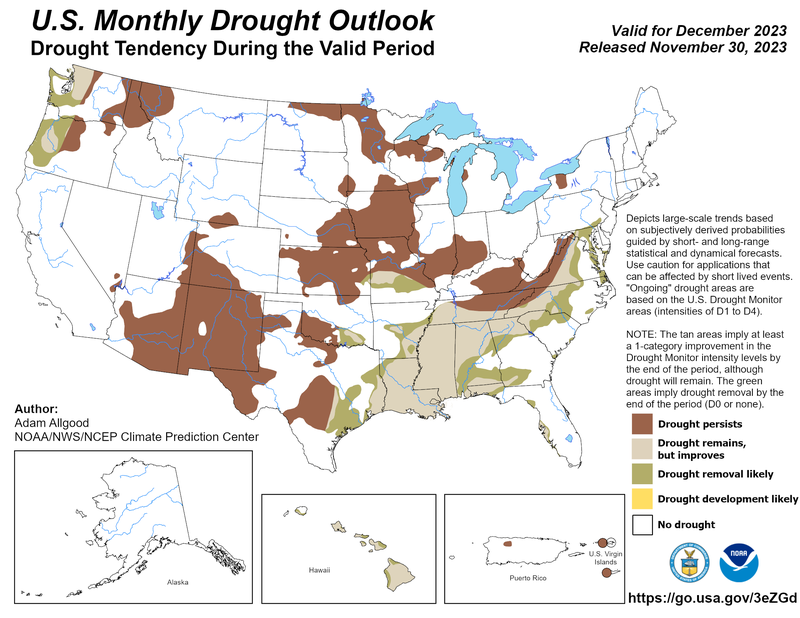
The Climate Prediction Center’s Drought Outlook for September highlights drought improvement and removal in Texas and Arkansas. However, drought is forecast to continue through September in eastern Arkansas.

Weather Synopsis:
Last week was cool and wet for most of the Southern Region. A middle-atmosphere "trough" brought unstable air to the Southern Region, producing three rounds of low-pressure systems, two of which brought abundant rainfall along a path of high precipitation from Texas to Tennessee. The remnants of Hurricane Lorena also brought rainfall to the western half of the Texas Trans Pecos.

Weather Prediction Center’s Surface Analysis valid 1am CDT on September 2, 2025.
Temperature:
Climatologically, September is the fourth hottest month of the year for the Southern Region, ranking behind June. The Region often sees daily average temperatures in the high 70s, while southern portions of Texas and Louisiana remain in the low 80s.


Last week, most of the Southern Region felt cooler than normal for this time of year. Daily average temperatures were abnormally low in areas that felt persistent northerly winds and experienced frequent rainfall. Oklahoma, especially experienced temperatures of 6-9 degrees Fahrenheit below average. Otherwise, portions of Texas and Louisiana experienced temperatures of 3-6 degrees Fahrenheit above average. The week’s hottest days were Wednesday, Thursday, and Friday, especially in South Texas, where temperatures reached 108°F in Freer. The city recorded its highest temperatures yet for the year, along with many other stations along the southern margins of the Region.
Precipitation:
With most of the Region located in a humid subtropical climate zone, rainfall occurs at any point of the year. During the fall months, frequent cold fronts initiate severe thunderstorms and rain showers. Tropical systems continue to impact the Southern Region’s weather patterns both directly and indirectly.


Widespread rainfall occurred across the Southern Region, especially in Texas and Tennessee. Several disturbances and fronts produced rainfall throughout the week. The week’s highest accumulations were in Texas: the Edwards Plateau, North Central, and East Texas regions, where over 6 inches of rain fell. The heaviest rainfall occurred within Texas on Sunday, when 4.65” was observed at a CoCoRaHS station in Conroe. Large portions of western Tennessee and northeast Louisiana also recorded over 4 inches of rain. Overall, portions of every state in the Region recorded over 2.5 inches of rain throughout the week.
Drought:


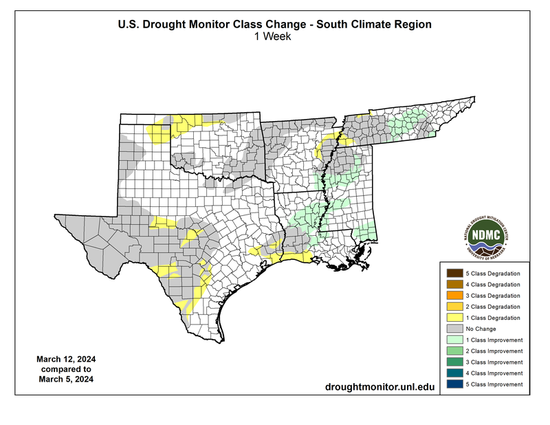
Across the Southern Region, overall coverage of Abnormal Dryness (D0) to Exceptional Drought (D4) takes up 44% of the land area. Dry conditions throughout the Southern Region contributed to widespread expansion of (D0) conditions in every state. Fortunately, heavy rainfall from the previous week, observed in eastern Texas, northern Louisiana, northern Arkansas, and central Oklahoma, led to improvements in drought. Little precipitation during August in Tennessee resulted in the expansion of Moderate and Severe Drought (D1-D4) to over half of the state. Last week’s precipitation, discussed above, will be considered in the next assessment of the drought monitor.
